Whether walking in the woods, on the shore, or over the rocks, I try to pay attention. I am always astonished!
Category Archives: Travel
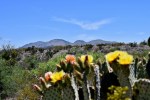
Squandering Our Gifts Amid Majestic Beauty
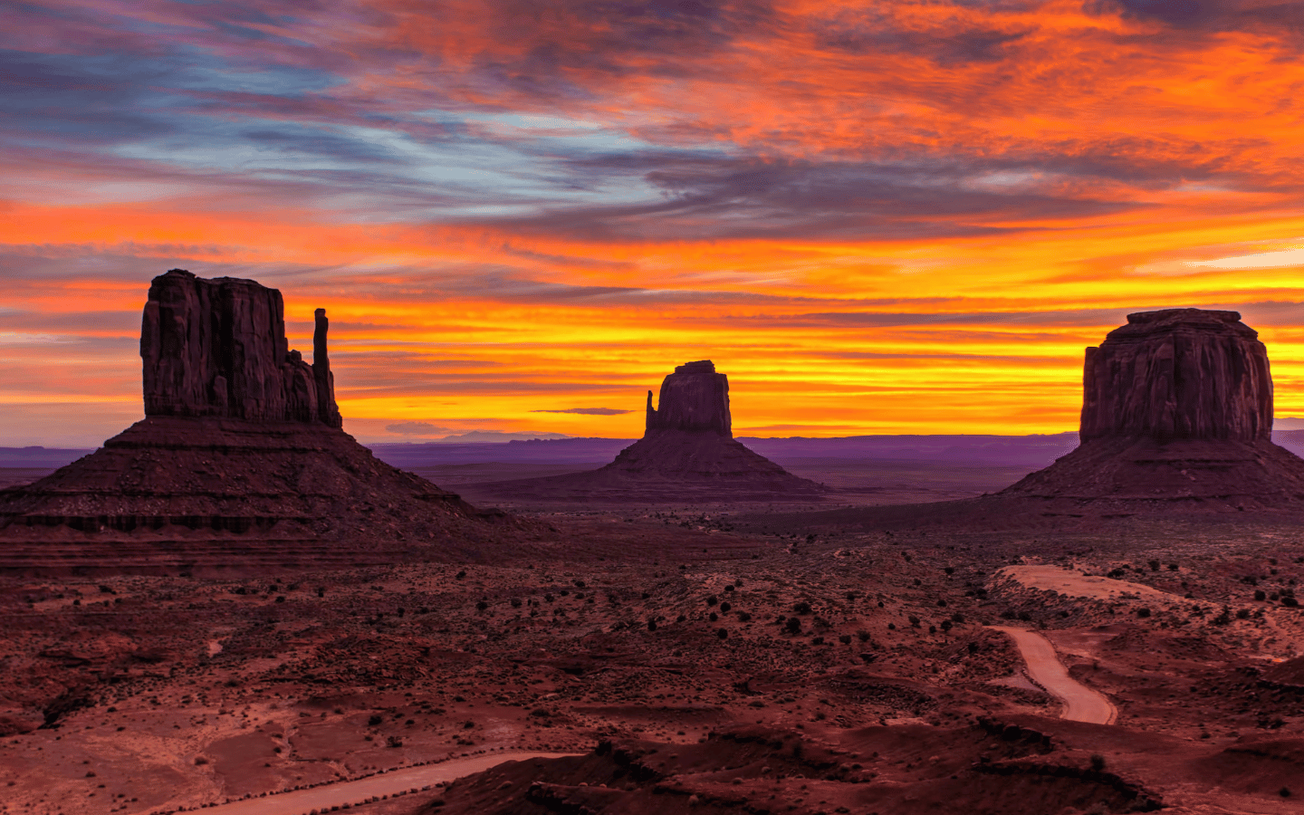
I am still reflecting on my experiences from a recent tour of the Four Corners area: the glorious landscapes, the vast vistas from challenging hiking trails, rafting on the clear waters of the San Juan River, and gazing at the star-filled night sky with the Big Dipper seemingly within reach.

Detours, Doubts, and Destinations
On Saturday, October 7, 2023, we left our campground in Fancy Gap, VA heading south on the Blue Ridge Parkway through the Appalachian Mountains destined for Stone Mountain State Park just across the state line in North Carolina. We anticipated an approximate 45-minute drive followed by some fun hiking. We noted the expansive vista at Piedmont Overlook and commented on the numerous residences and rolling hills of perfectly aligned rows of very green bushes. Only later did we surmise that they were Christmas trees! We questioned the origins of flawless green meadows, aka balds, along the ridgeline some dotted with brown rolls of hay. Were the balds natural or had they been cleared? Perhaps a combination of both.
These sights were different from our earlier drives along the southern parkway near Asheville, NC where there were no residences in sight nor open meadows as we drove through densely forested slopes rising high on one side and plunging steeply on the other.
We were making good progress, and all was going well until we saw the sign, “Road Closed Ahead,” an ample warning for the upcoming barricade and huge “Detour” sign both decked out in bold highway orange. We followed the detour signs even as we sensed they were taking us back north instead of our intended south. Initially, the signs were clearly marked “Blue Ridge Detour South.” We entered a small town and passed a sign that simply read “Detour.” We began to doubt that decision, turned around and followed the sign driving into a residential area which seemed odd for a highway detour.
Shortly, we saw one of those portable, flashing, marque highway signs declaring “Blue Ridge Detour, No Thru Traffic” which seemed contrary to the nature of a detour. We passed it, doubted our decision because I had seen an orange sign just beyond the directed turn. We turned around, made the right as indicated and within a block saw the orange sign detouring us back to the left. At that point we encountered an open gate – “Detour” sign on one side, “Local Use Only” on the other — and drove into a pumpkin patch. Hummm??
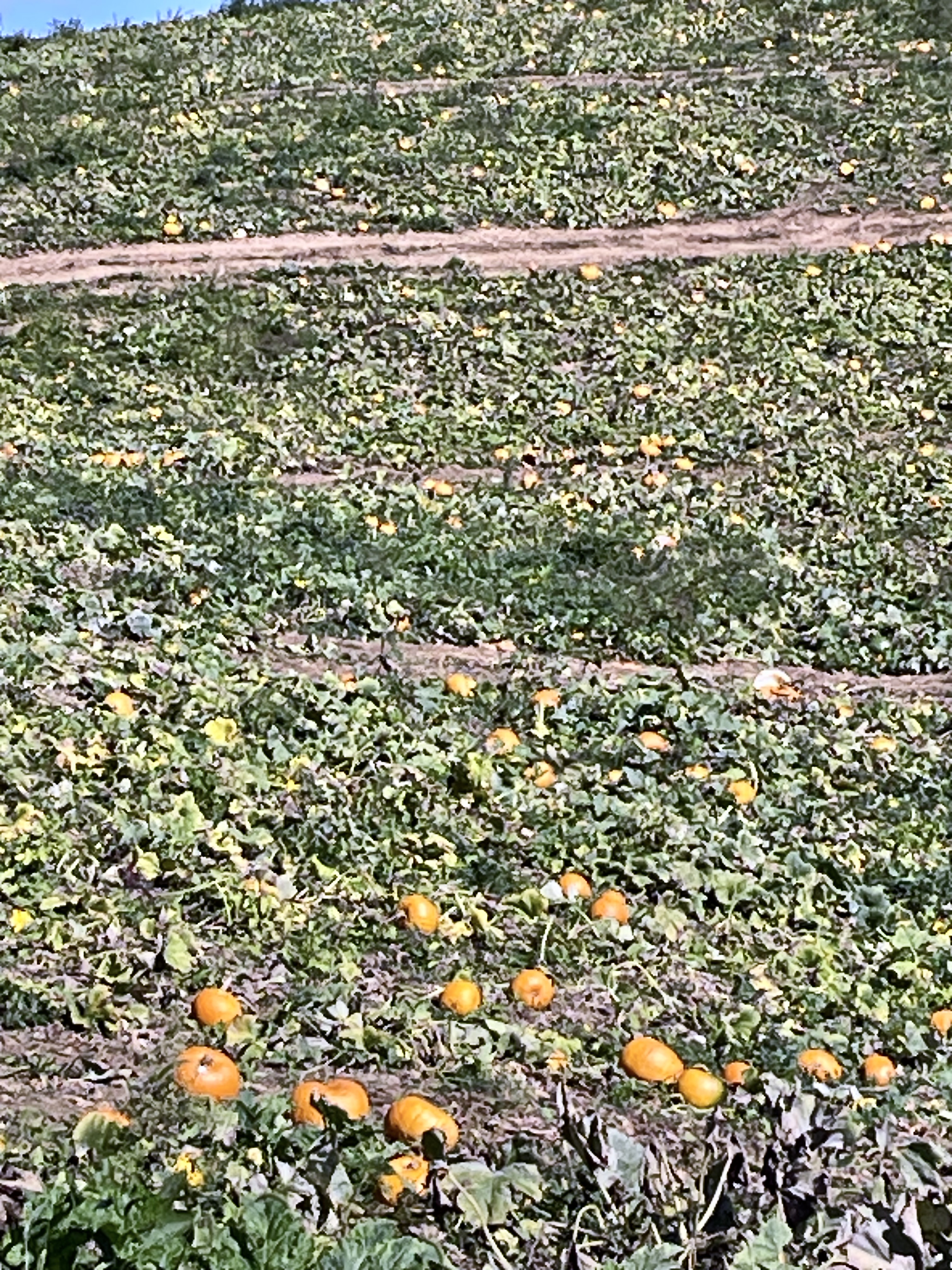
The road through the huge pumpkin field appeared to be relatively new white shale and gravel. We surmised that the highway department must have made this improvement for the detour as the other roads weaving through the pumpkin path were rutted dirt. We also saw a gray car moving ahead and below us through the terraced pumpkins which buoyed our optimism that we were on the right road. We were in awe of the pumpkin patch. As far as we could see were green vines dotted with various sizes of orange and occasionally green pumpkins. I must confess that I secretly desired to stop and pick a pumpkin but ultimately decided that would not be a wise thing to do. Ominously, the road narrowed, and we met the gray car coming back out. Not a good sign!! Momentarily, we too encountered the machinery and barricade, “Road Closed.”
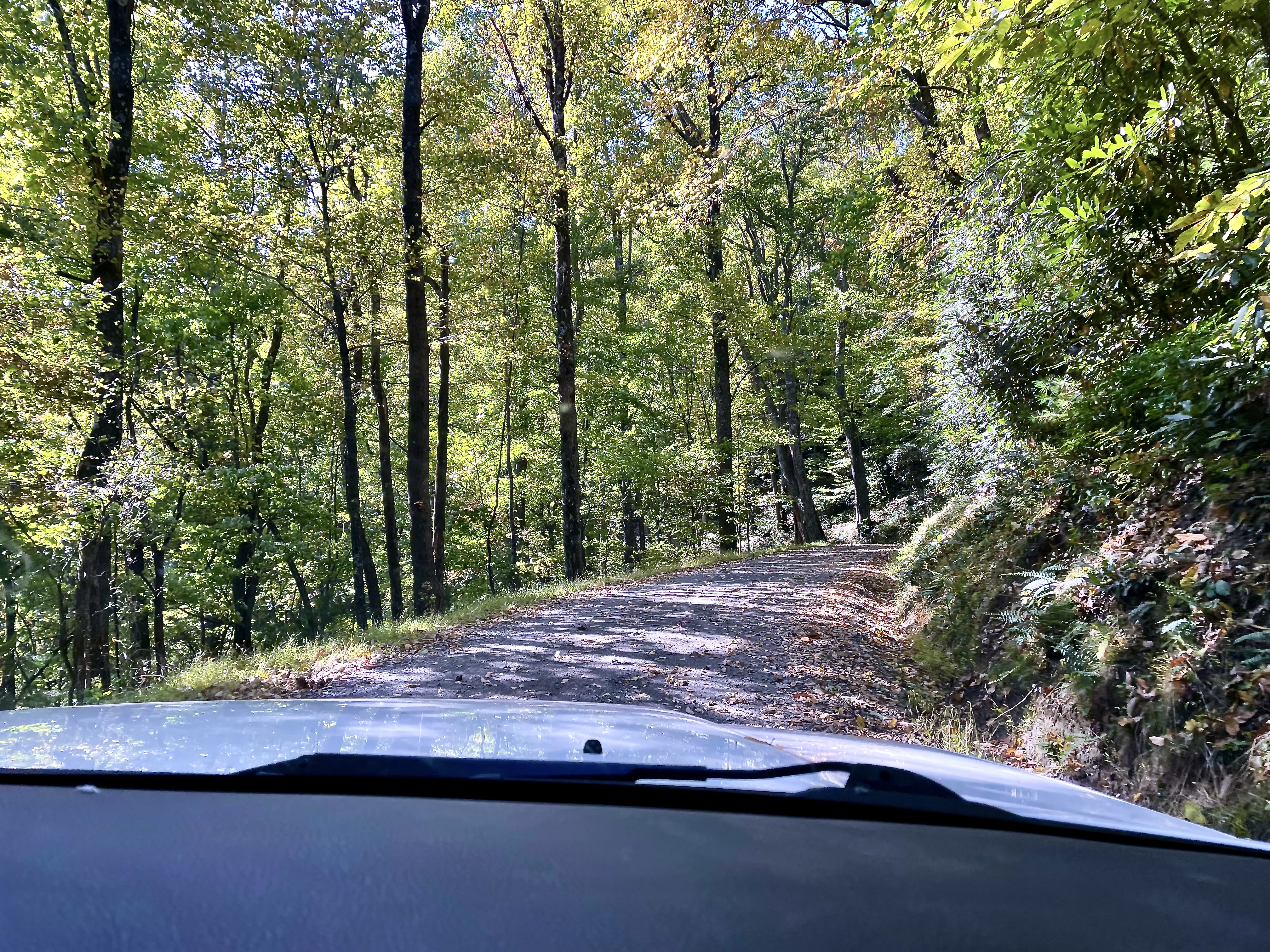
Back we went through the pumpkins to the flashing detour sign to discover that it read, “Blue Ridge Detour Ahead.” Sure enough, a couple of miles farther was yet another detour sign, again not indicating “Blue Ridge,” that took us down a winding country road. The next sign of note was “Pavement Ends Ahead” which indeed it did, leaving us driving on a narrow gravel road at times passing through trees just wide enough for the car and boasting a steep drop off to the left and a densely forested mountain side to the right. Just a bit spooky!
Already weary of the detours and the doubting, I had entered Stone Mountain into our GPS. We reached an intersection with a paved road where the GPS indicated a right turn. In the middle of the intersection turning around was the little gray car of the pumpkin patch. A barricade blocked the right turn! We spoke to the car’s lone occupant, and she, like us, was baffled and frustrated. Her comment, “Would you believe I just drove through a pumpkin patch.” We all chuckled as we shared that we had done the same. She was from Belgium and was trying to get to Asheville. The country roads and directions were foreign and confusing to us, we could only imagine her experience of them. We wished her well as she decided to turn around and go back. We chose to turn left and let the GPS recalculate a route to Stone Mountain.
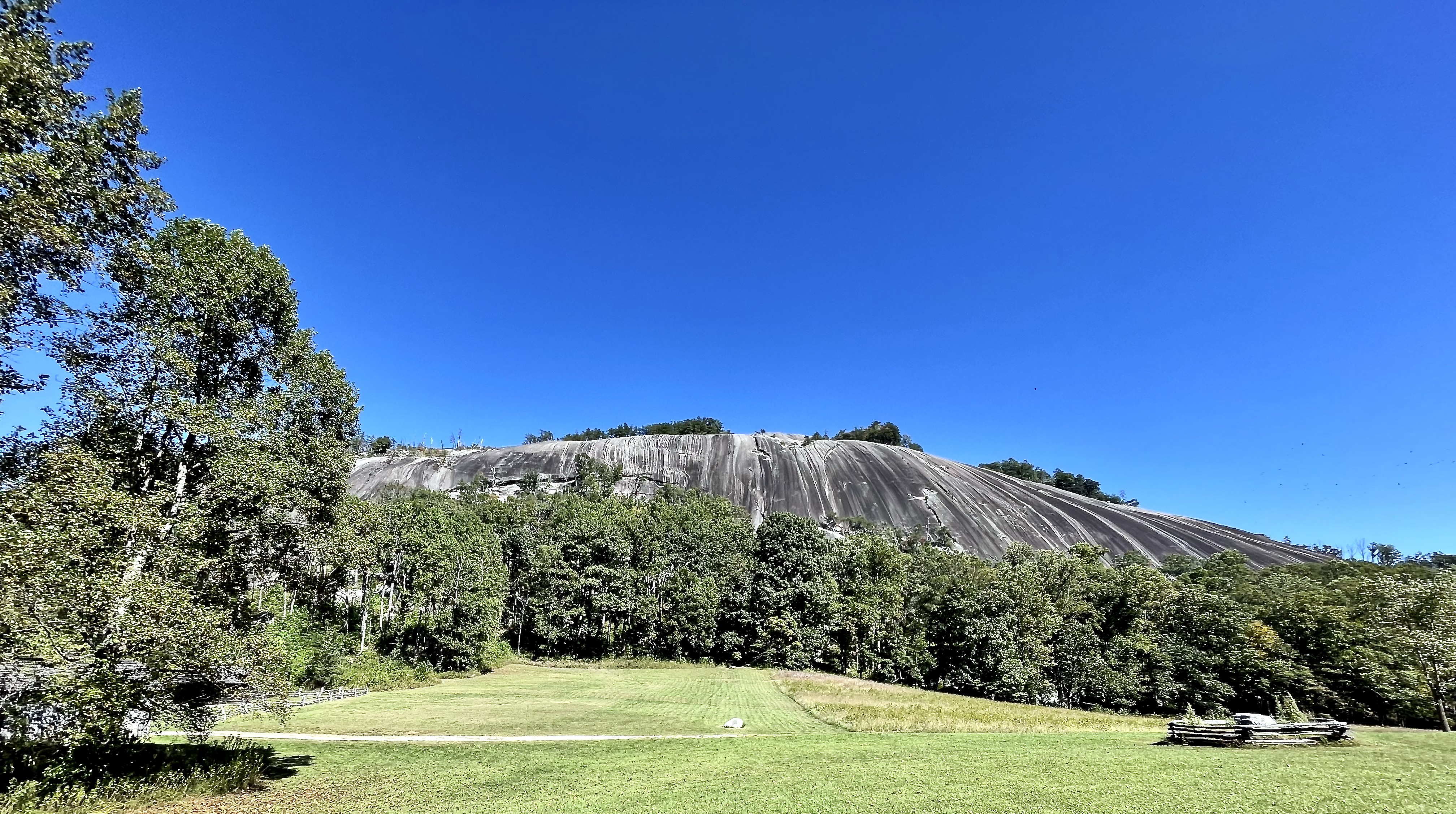
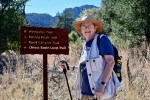
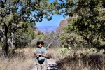
A 45-minute drive became two hours. Ultimately, Stone Mountain was well worth the extended trip. Stone Mountain itself was majestic and naturally beautiful. Unmarred by any elaborate carvings as seen on the perhaps better known Stone Mountain outside of Atlanta, GA. The hiking trails offered solace and some solitude. The water music, tumbling and gurgling over the creek bed rocks or gushing as it rushed over the various falls at heights of two to twelve to 200 feet, was soothing and calming in its sparkling clarity and consistency. A special delight was hearing the trees sing as they swayed and hummed in the wind. All thoughts of the detours and doubts vanished under the serene canopy of the forest.
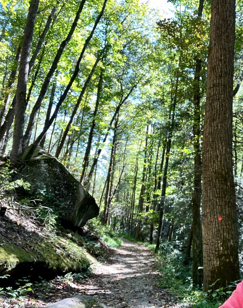

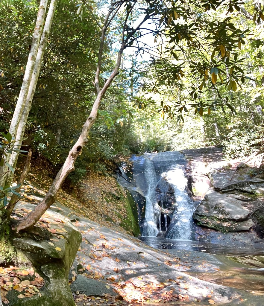
Stone Mountain Falls Trail. Stone Mountain Falls. Widow Creek Falls.

Limping Along on Faith

We pulled our little travel trailer from storage and headed out for a four-week road trip.
After 10 months of no travel, we embarked on an approximately 3,000-mile road trip with planned stops throughout the southeast. Preparation required some seemingly minor maintenance and repair for both the trailer and our towing vehicle.
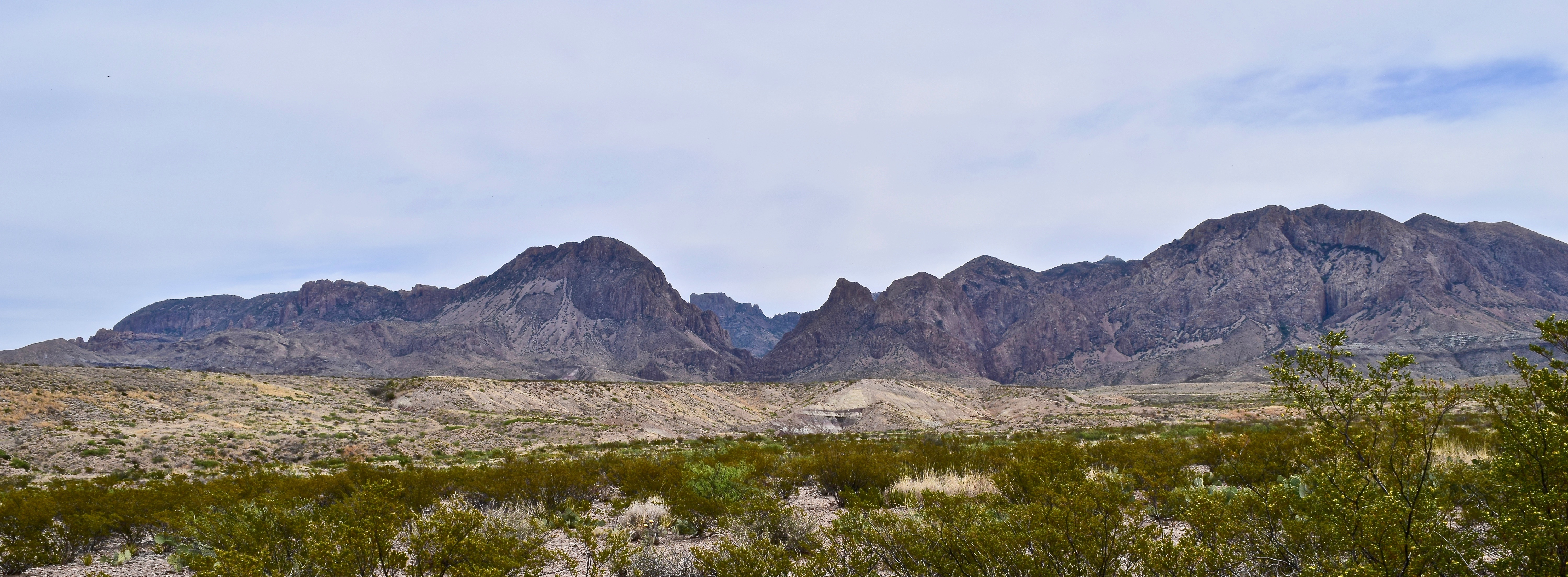
Big Bend Gallery
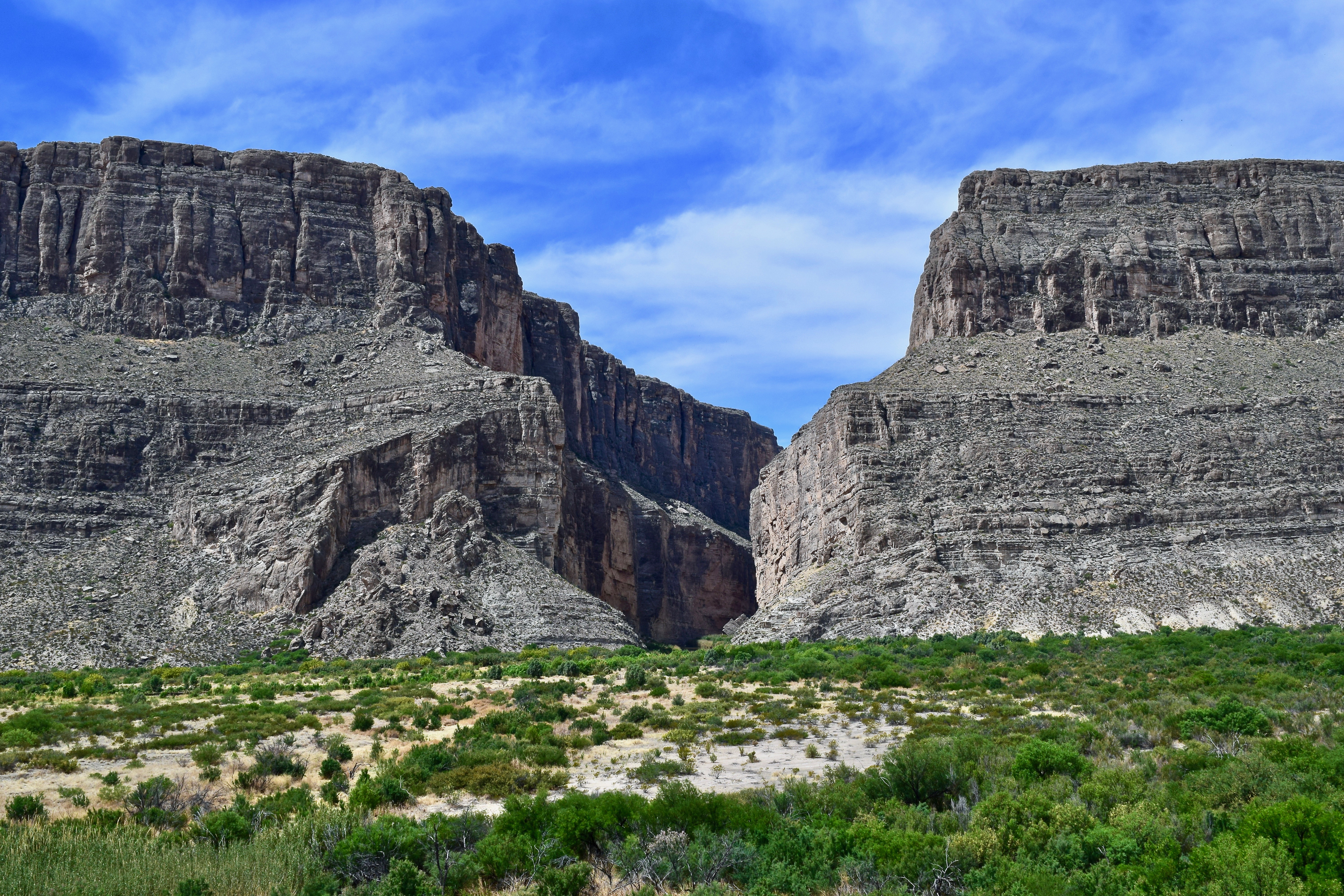
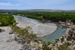
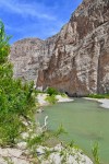
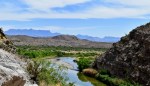
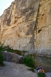
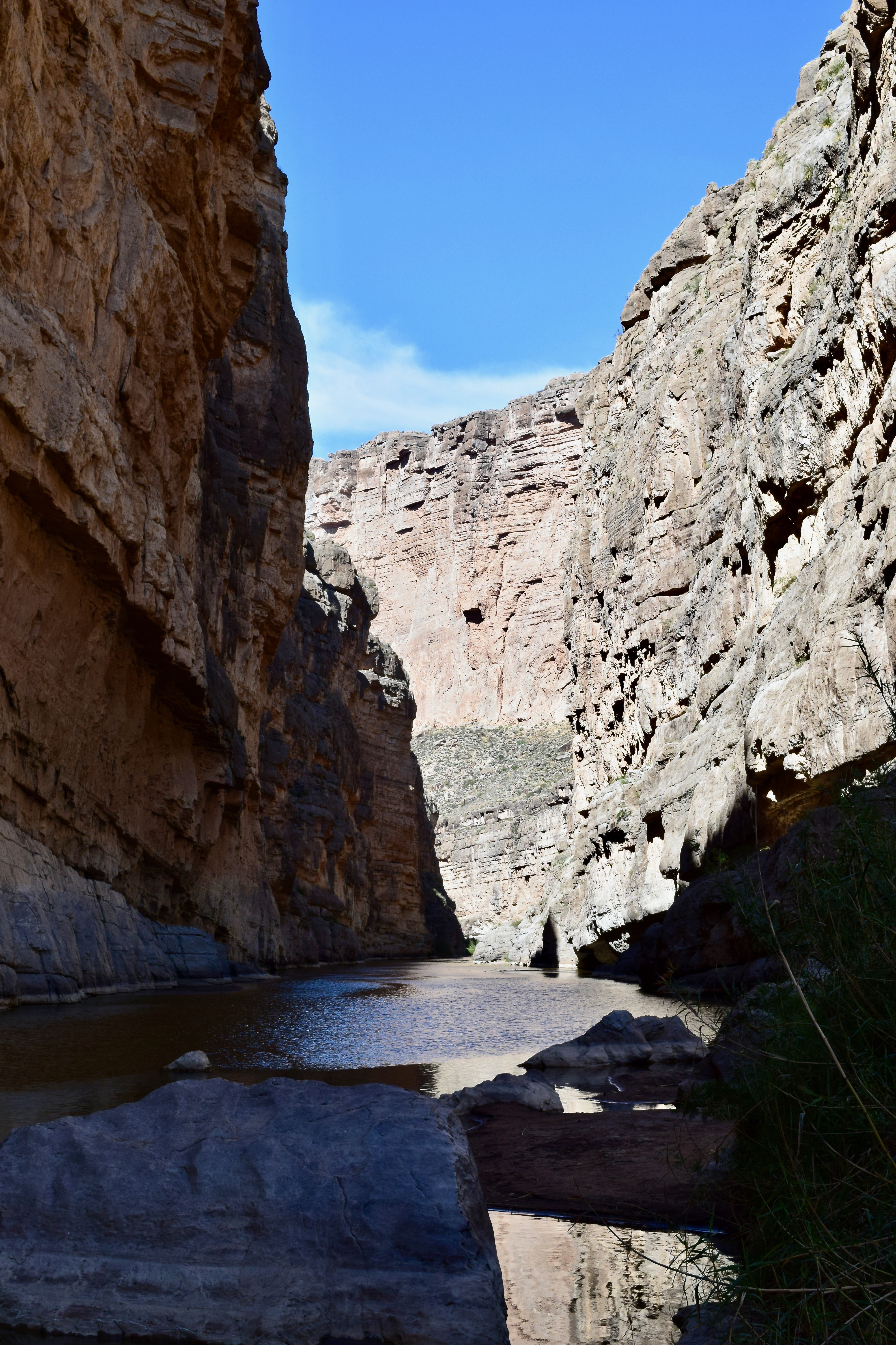
The gap where the Rio Grande exits the Santa Elena Canyon.
I am finally making public some of my photos from our April 2018 Big Bend Trip. Click on the first photo in each group and you can scroll through the photos in the light box. Unfortunately, I did not upload them all at once, so you will have to view them in groups: BOQUILLAS, THE WINDOW TRAIL, SANTA ELANA CANYON, CASA GRANDE.
I hope there is no wall built along the Rio Grande River. That is not a political statement, but an ecological statement. The land is awesome. The ecosystems both magnificent and fragile. The views are breathtaking. I can not imagine a wall on this sacred land. Take a look and enjoy!!
-

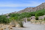
- BOQUILLAS: Boquillas Port of Entry is the only official Rio Grande River crossing along the 118 miles of river border in Big Bend National Park.
-

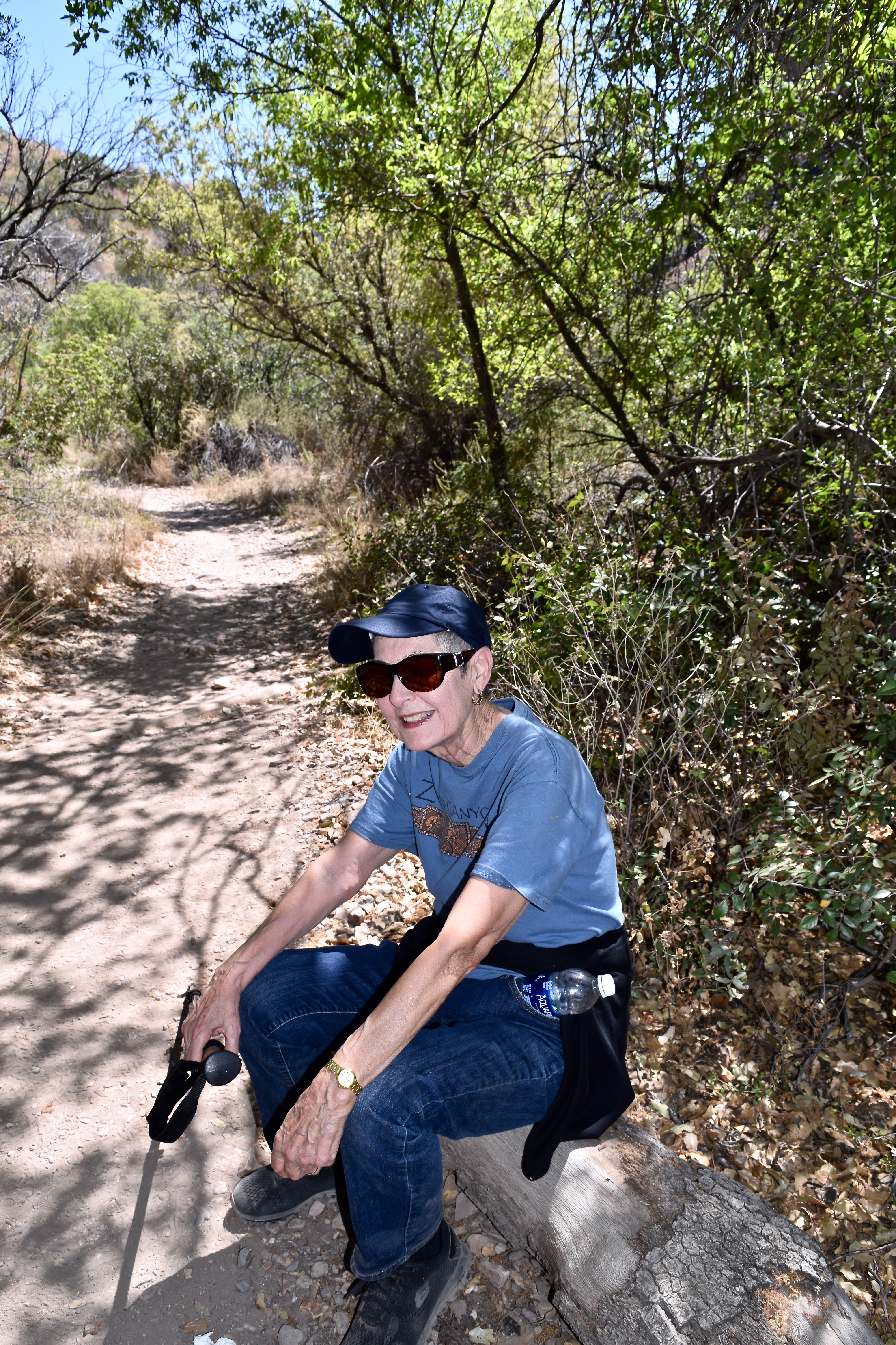
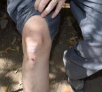
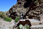
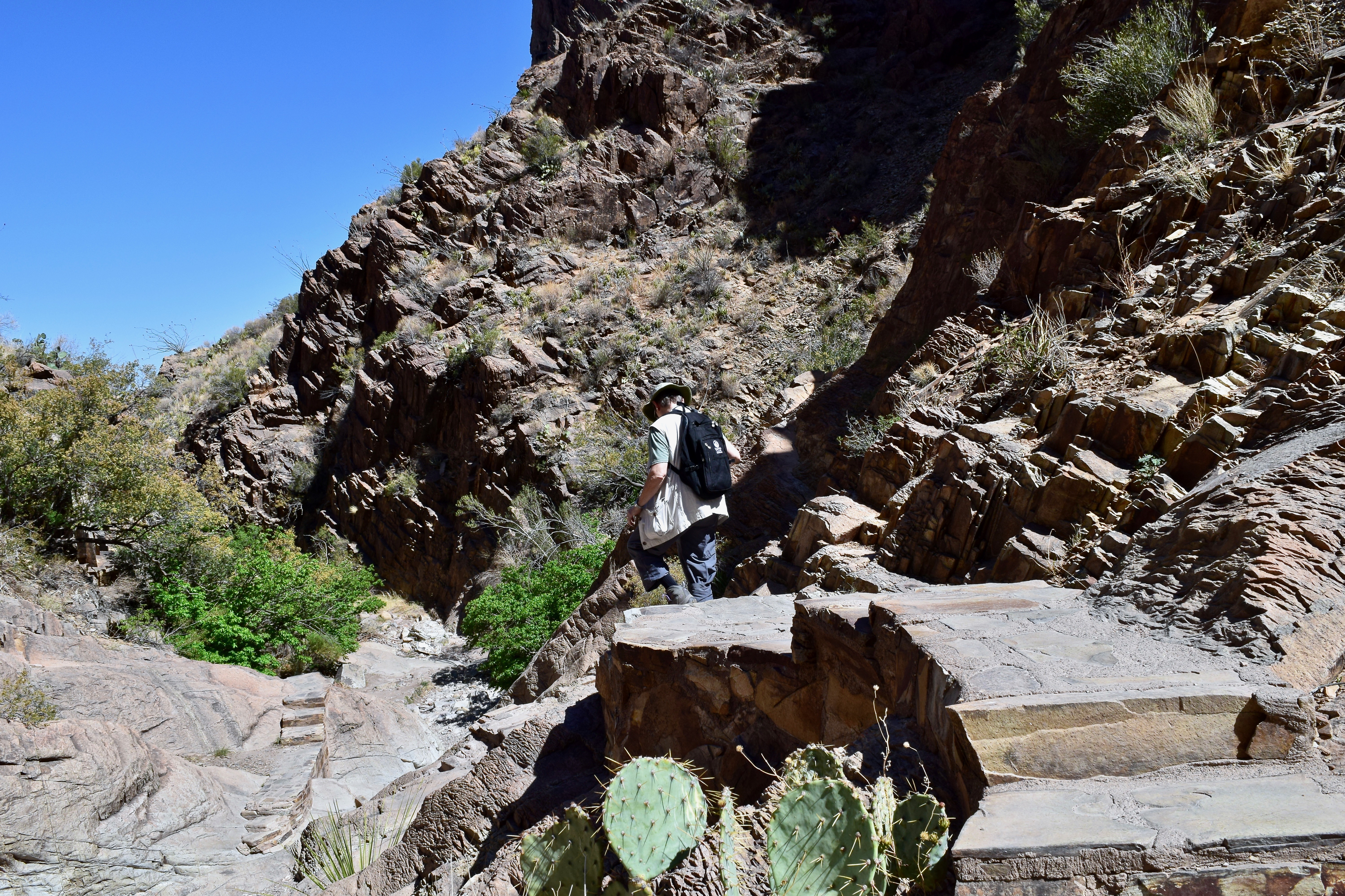
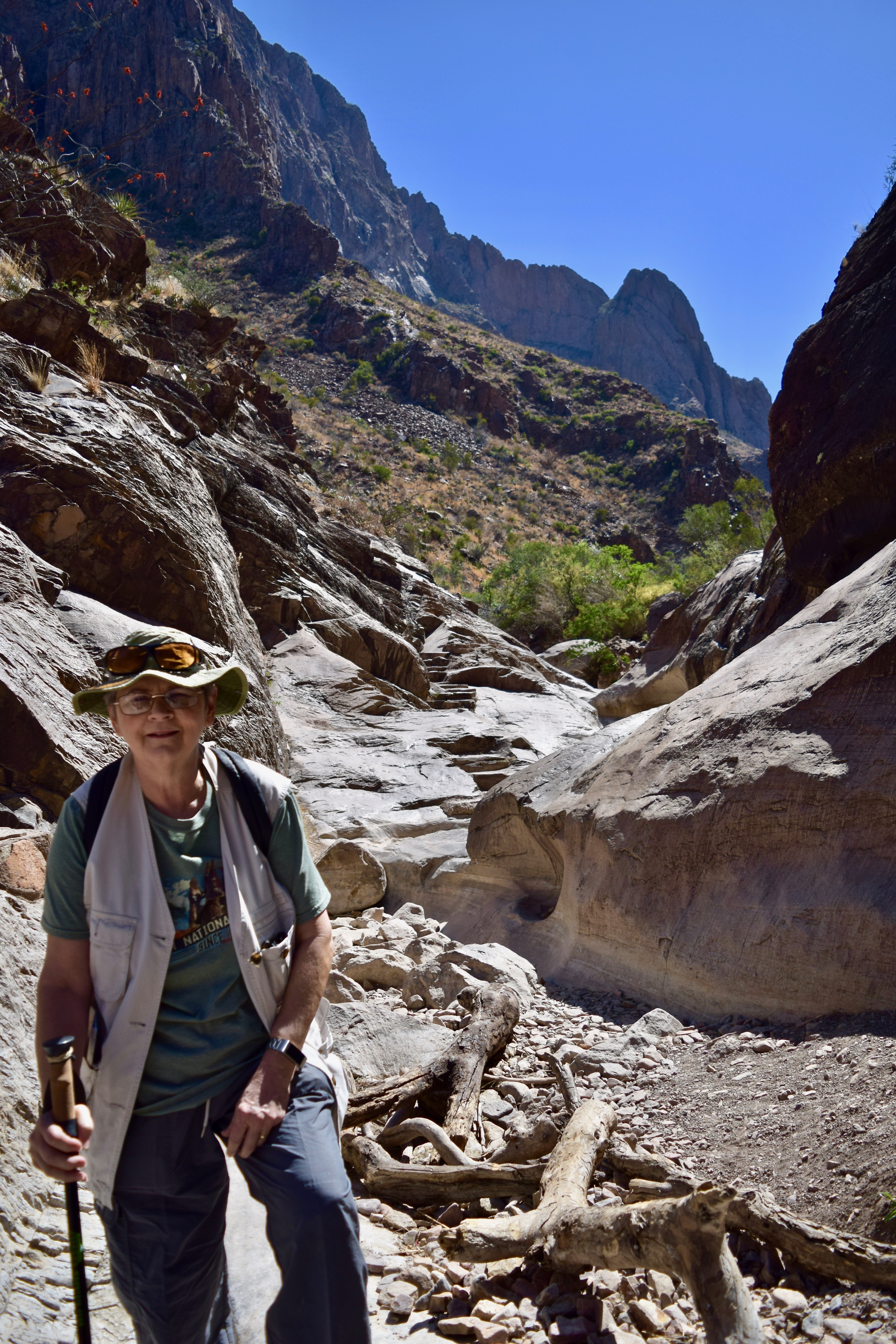
- Going up the Boquillas Canyon Trail with minimal pain two days after the knee injury.
-
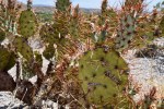
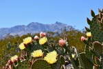
- The Spiny Fruited Prickly Pear cactus along the trail is a reminder to pay attention and stay on the trail.
-
- The Rio Grande winds its way to Boquillas Canyon.
-

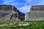
- Hickers dwarfed by the massive wall of the Sierra del Carmen on the Texas side of the river.
-
- Boats on the Mexico side of the river. It is reported that at times Mexican musicians use the boats to float up and down the river playing for the hikers. Sometimes they will toss sealed mason jars in the water hoping to retrieve them later filled with money from the hikers.
-
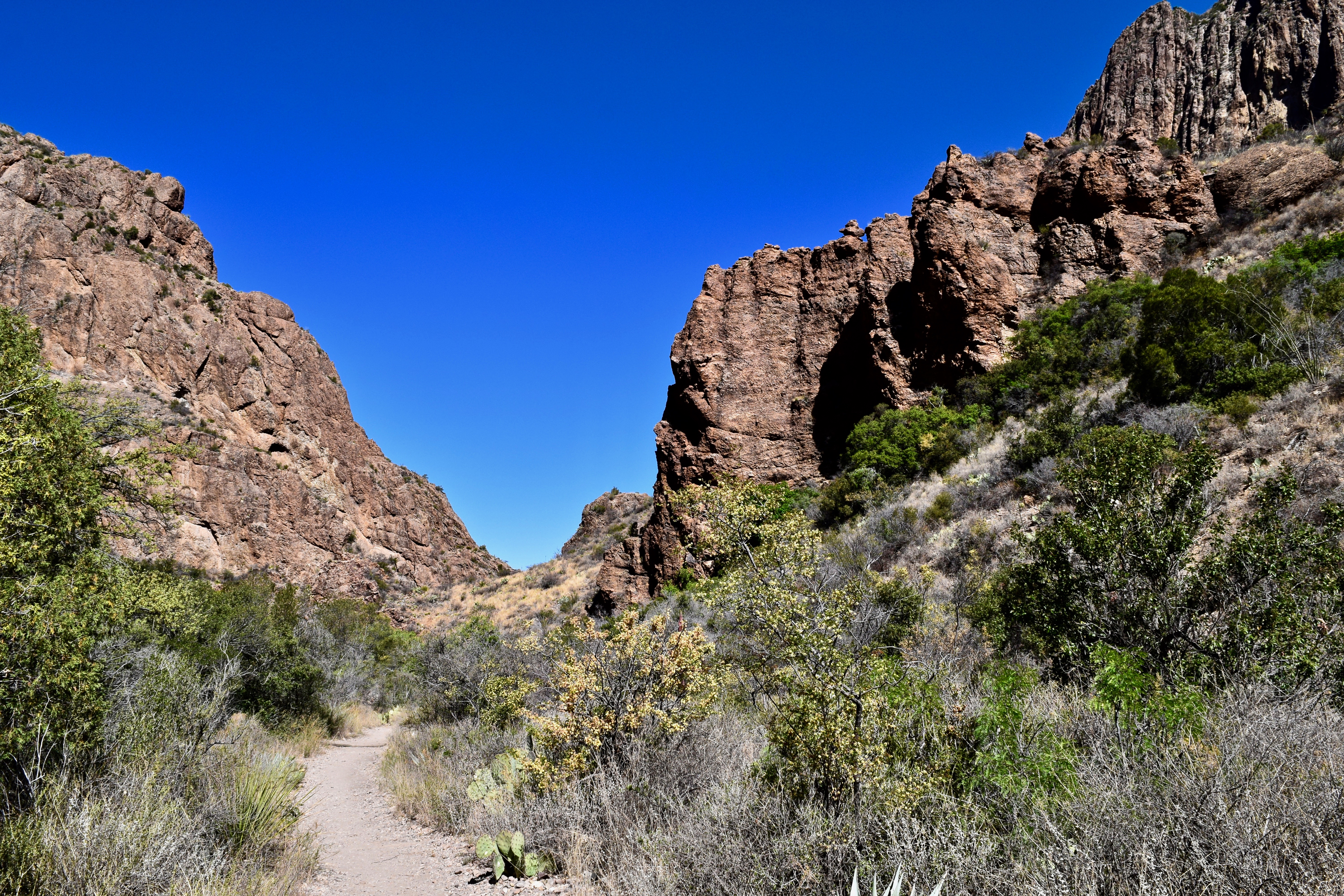
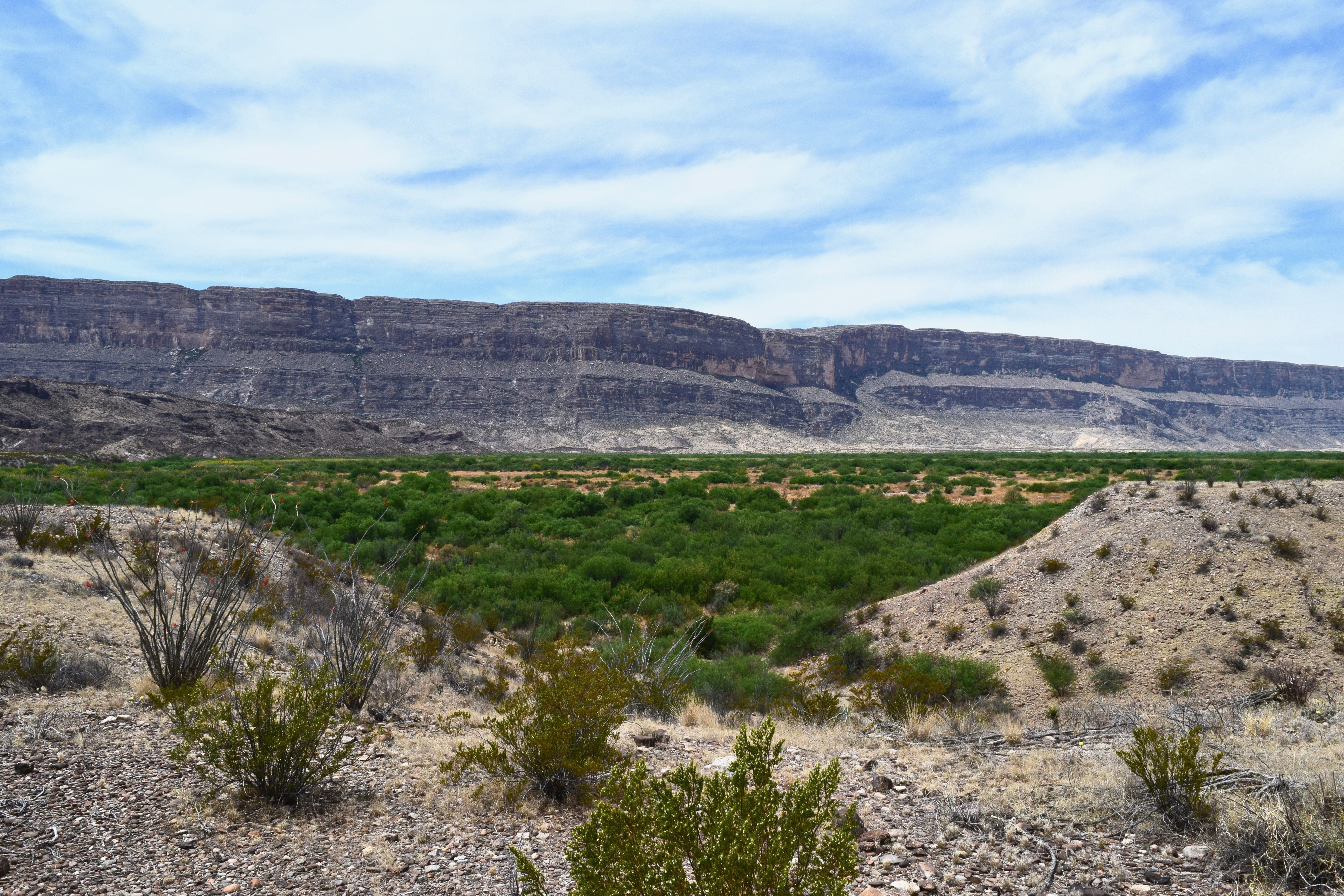
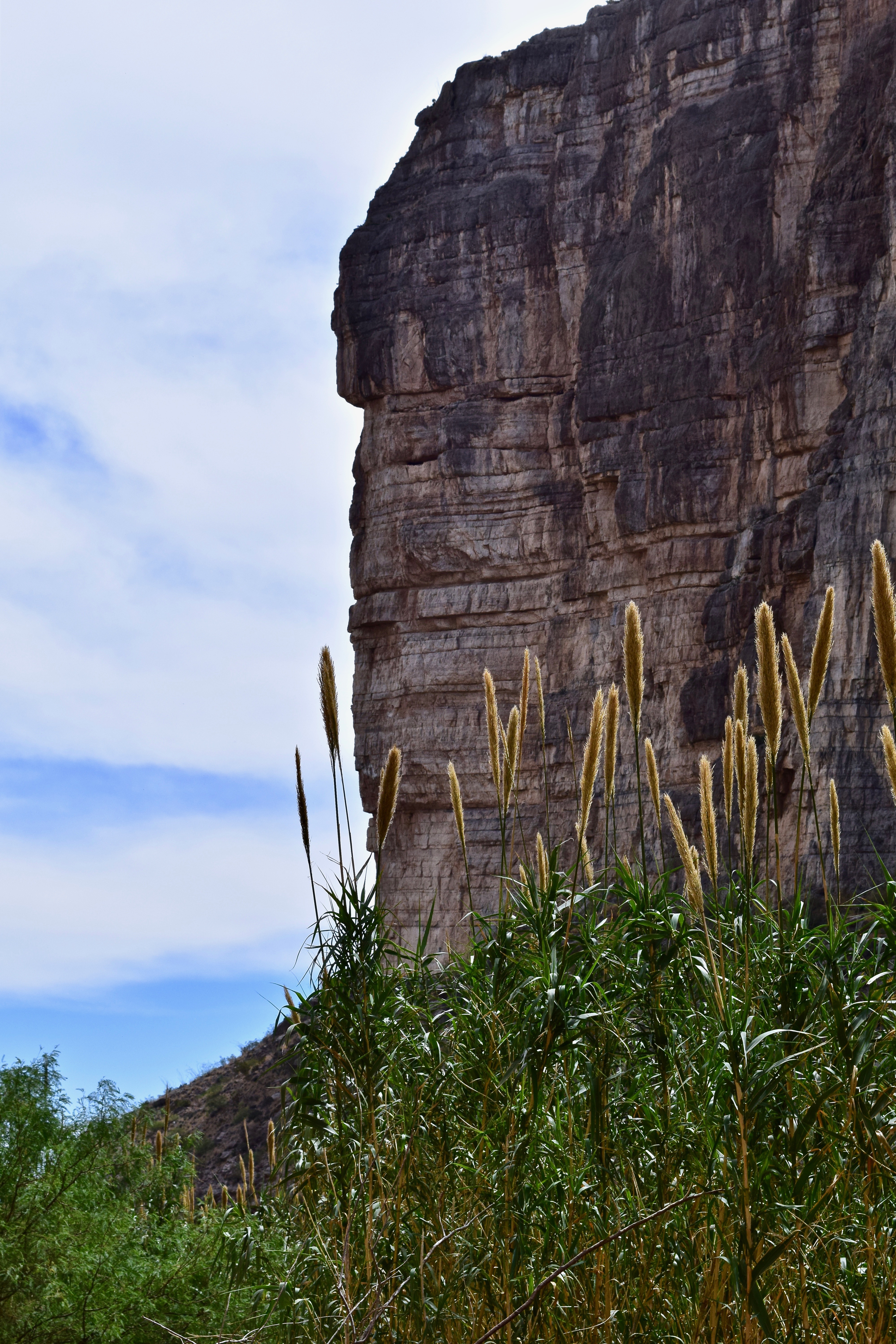
- The limestone and shale canyon wall near the near the entry of Boquillas Canyon–the longest and deepest canyon in Big Bend.
-
- Hiker heading back up the Boquillas Canyon Trail as others start the descent.
-

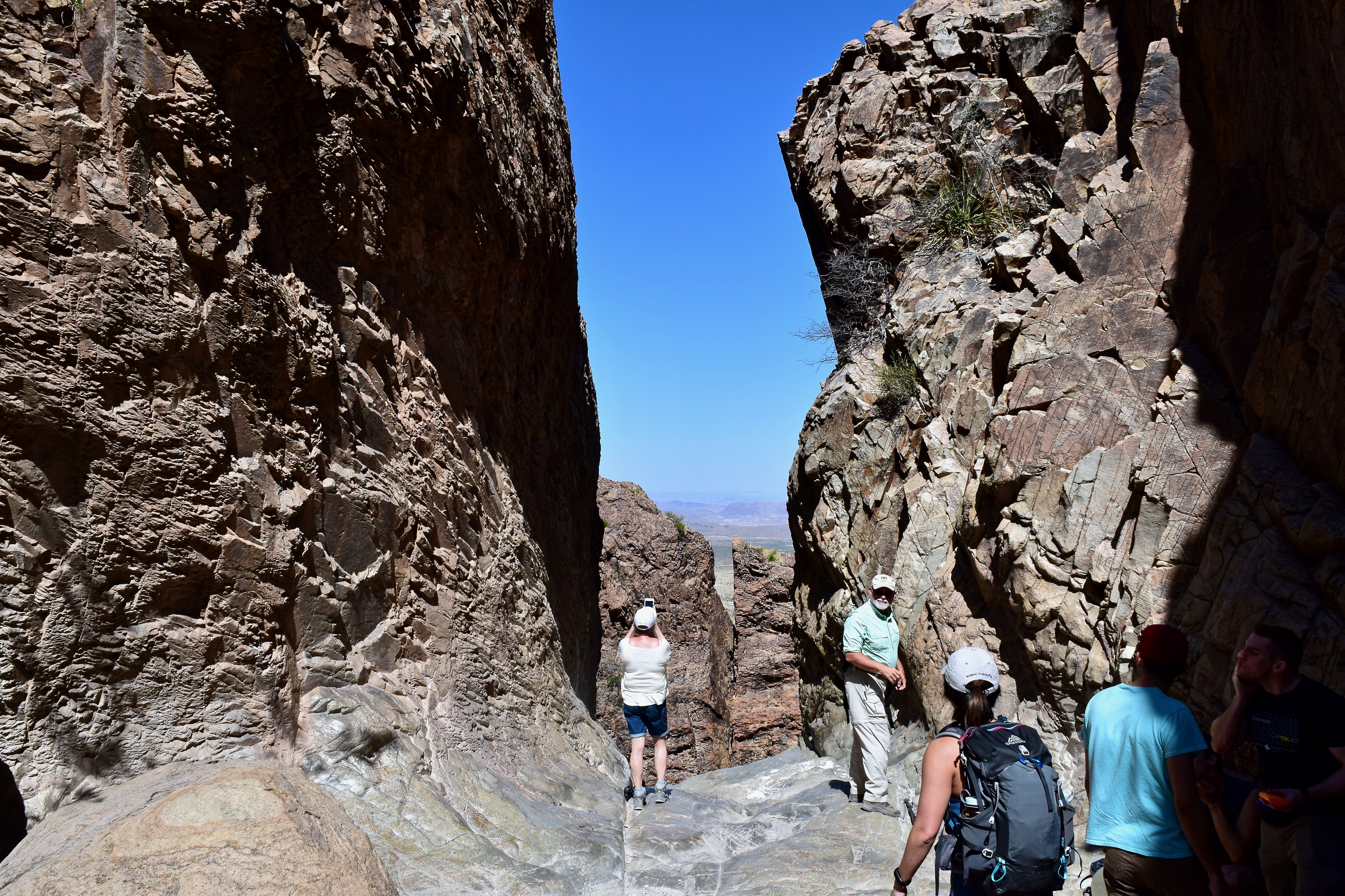
- THE WINDOW TRAIL: The Window Trail just before it descends again and becomes very rocky.
-

- One of many rest stops on the hike out.
-
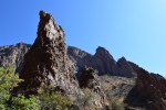
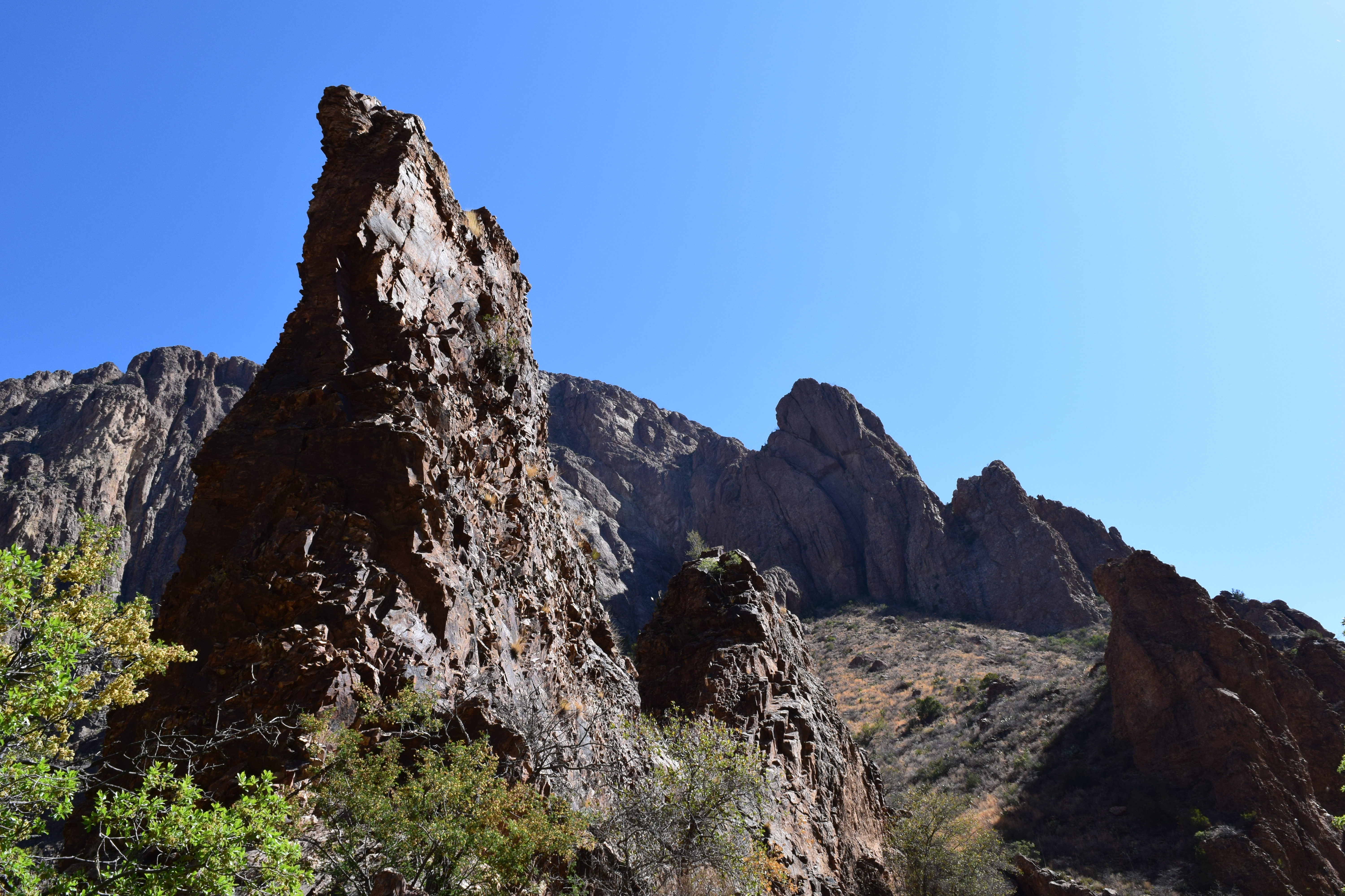
- Rock spires along the trail.
-

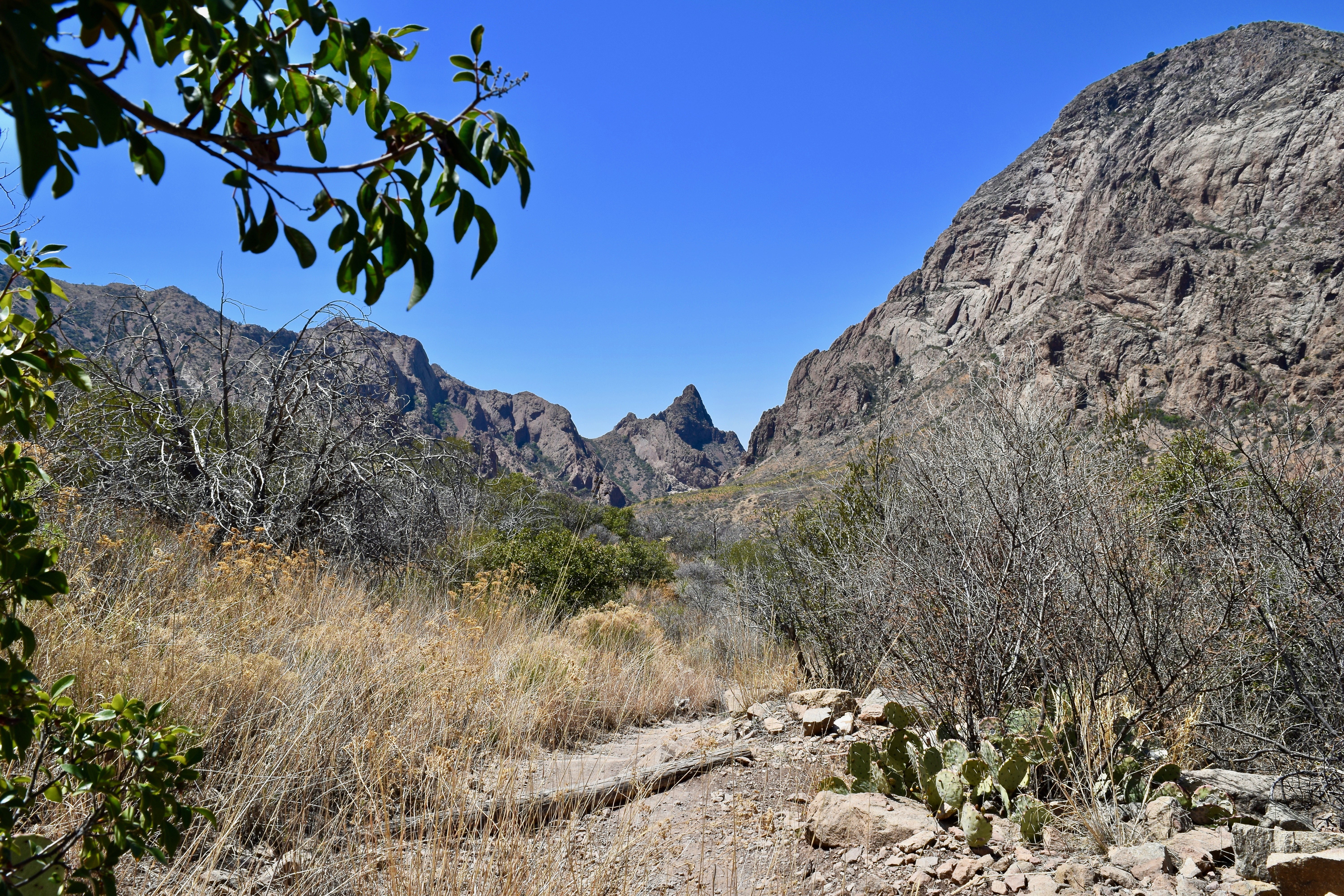
- A flatter portion of the trail-the Window is the crevice to the right of the peak in the distant center.
-
- Dealing with physical limitations.

-
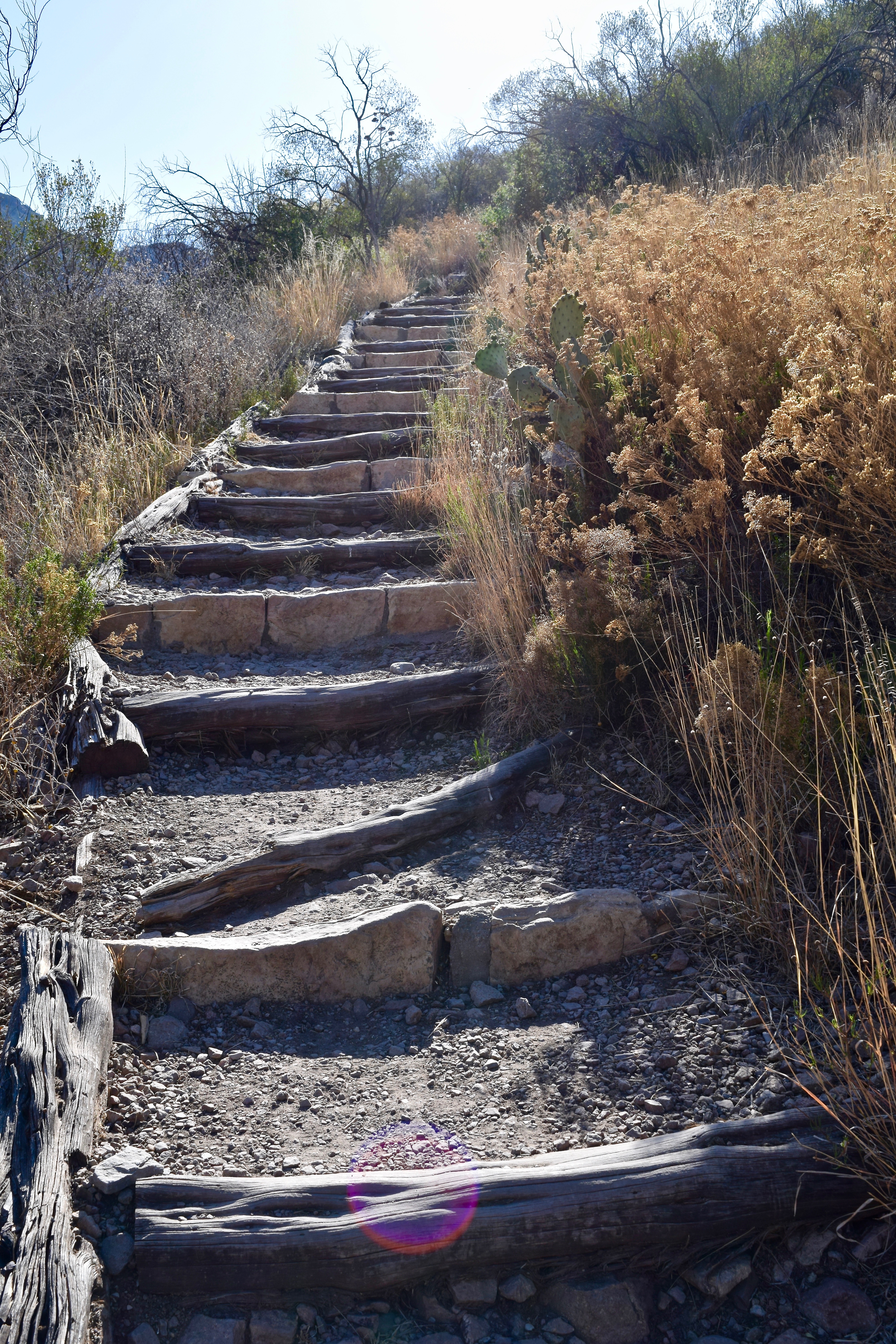
- Limping up and down the steep rock steps.
-
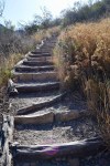
- Just a small portion of the climb on the return hike.
-

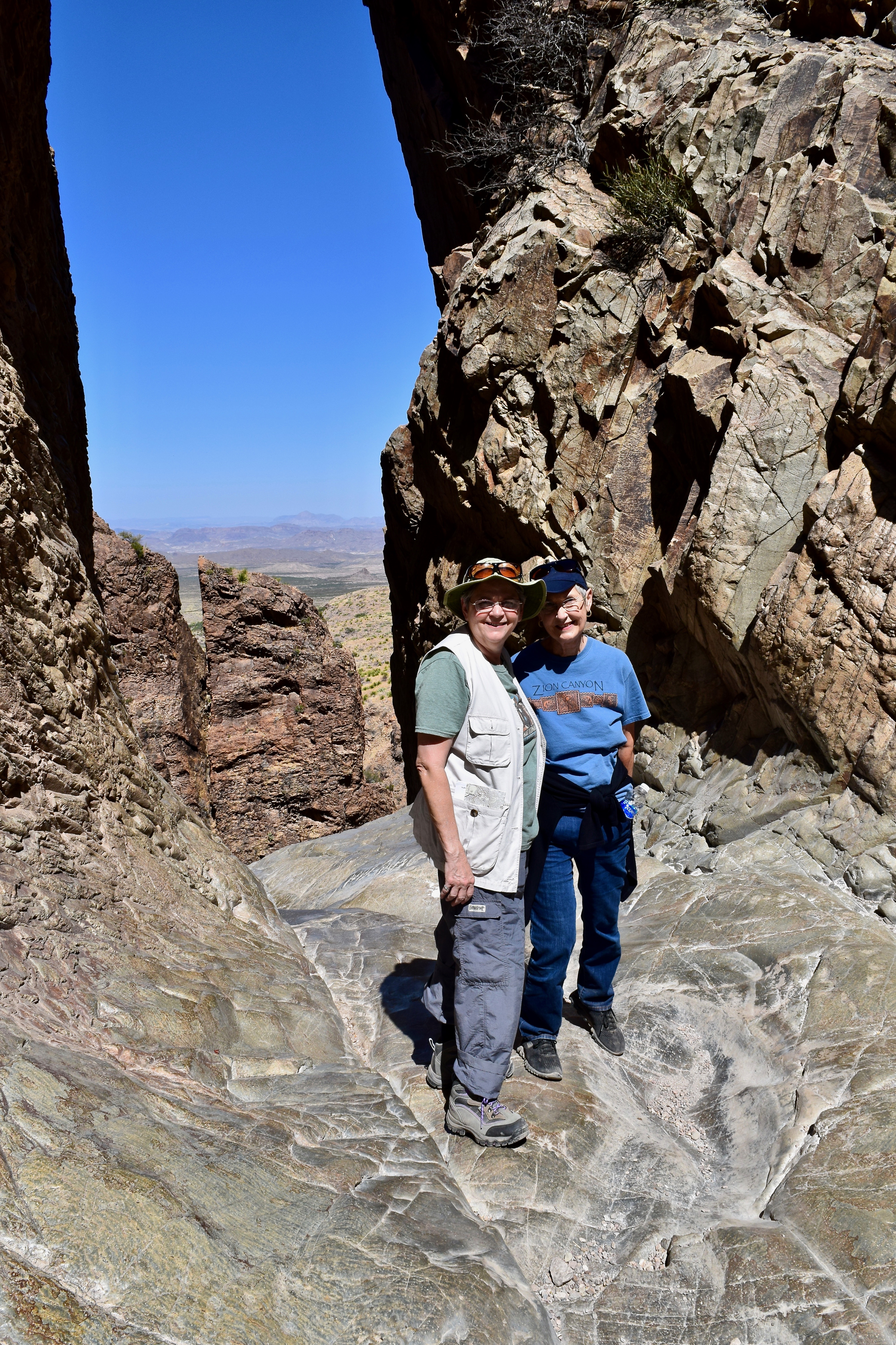
- Hikers enjoying the view and the shade at the Window.
-

- Brenda and Lou Anne with the desert below through the Window.
-
- The lower rocky portion of the Window Trail.
-
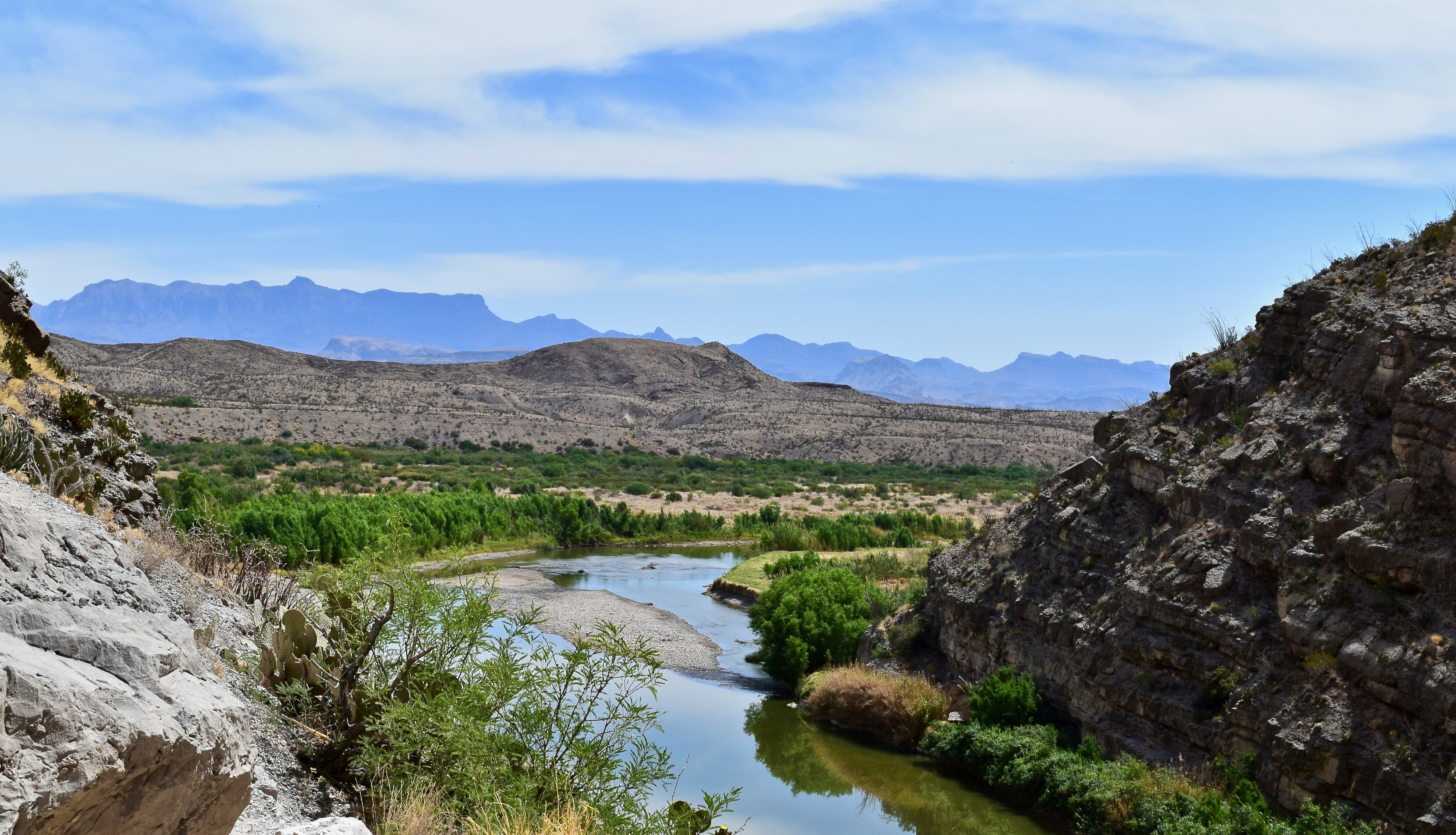
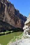
- SANTA ELANA CANYON: The Rio Grande making its abrupt turn into the Santa Elena Canyon.
-

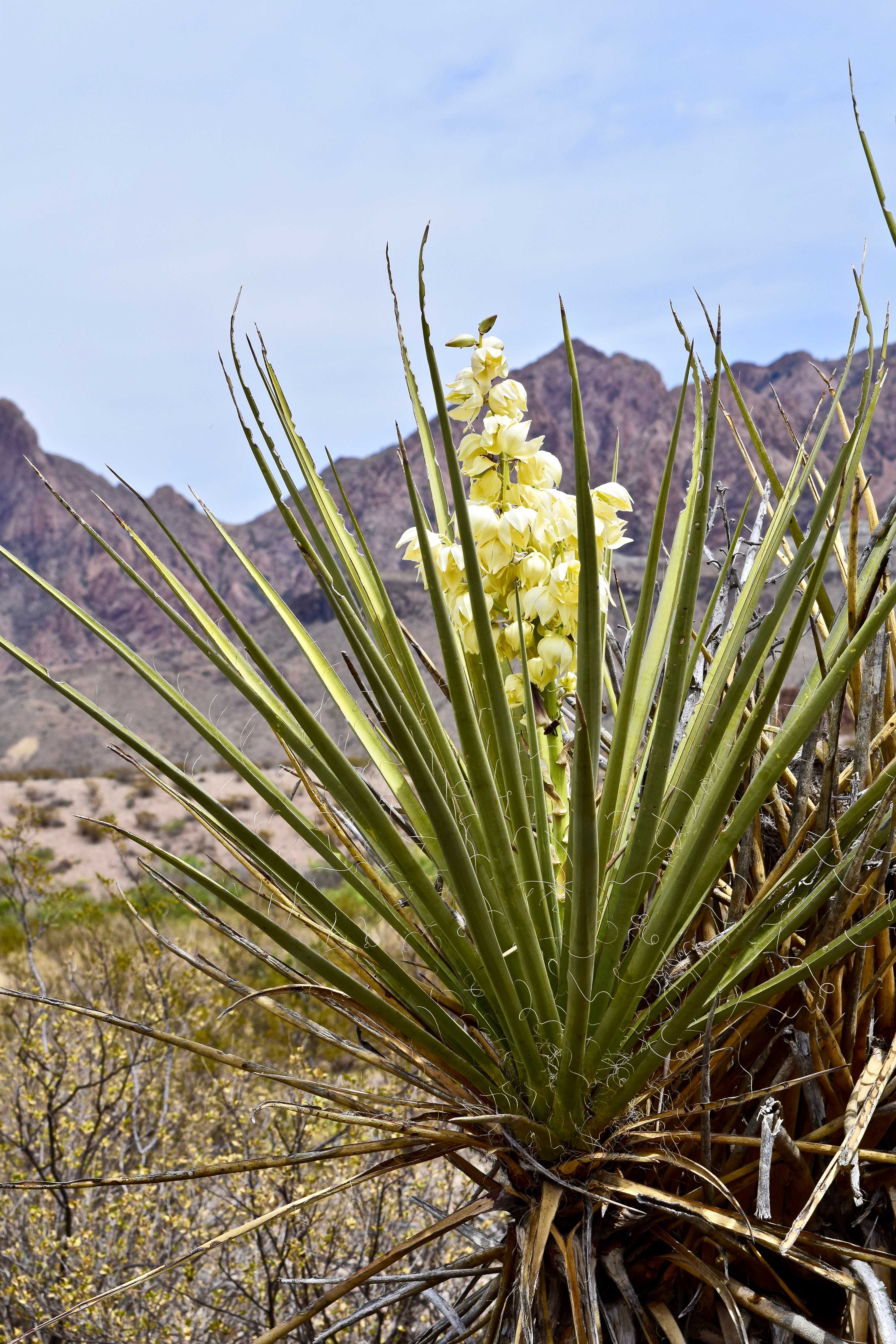
- Torrey Yucca with the Chisos in the background.
-

- The lower Santa Elena Canyon Trail plants, mountains, and sky offer an impressive array of colors and textures.
-
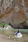
- Solititude at the end of the Santa Elena Canyon Trail.

-
- The gap where the Rio Grande exits the Santa Elena Canyon.
-

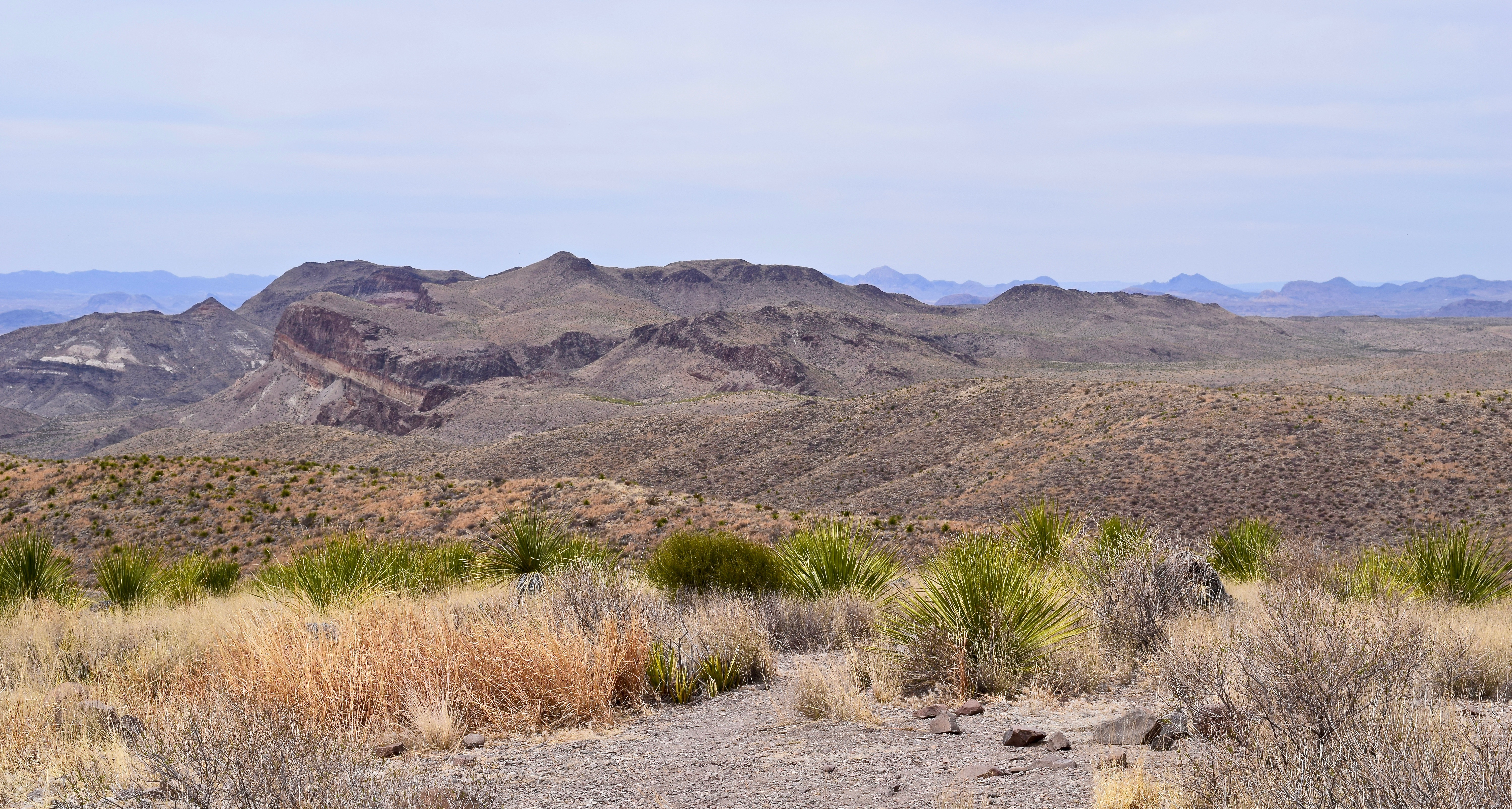
- A view of the diverse ecology found in Big Bend National Park–the desert, fertile river valley, and mountains.
-
- The Chisos range from Ross Maxwell Scenic Drive.
-
- The Rio Grande from the rocky cliffs of the Texas Mesa del Auguila.
-
- A view of the Mexican Sierra Ponce as the river enters the Santa Elena Canyon.

-

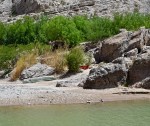
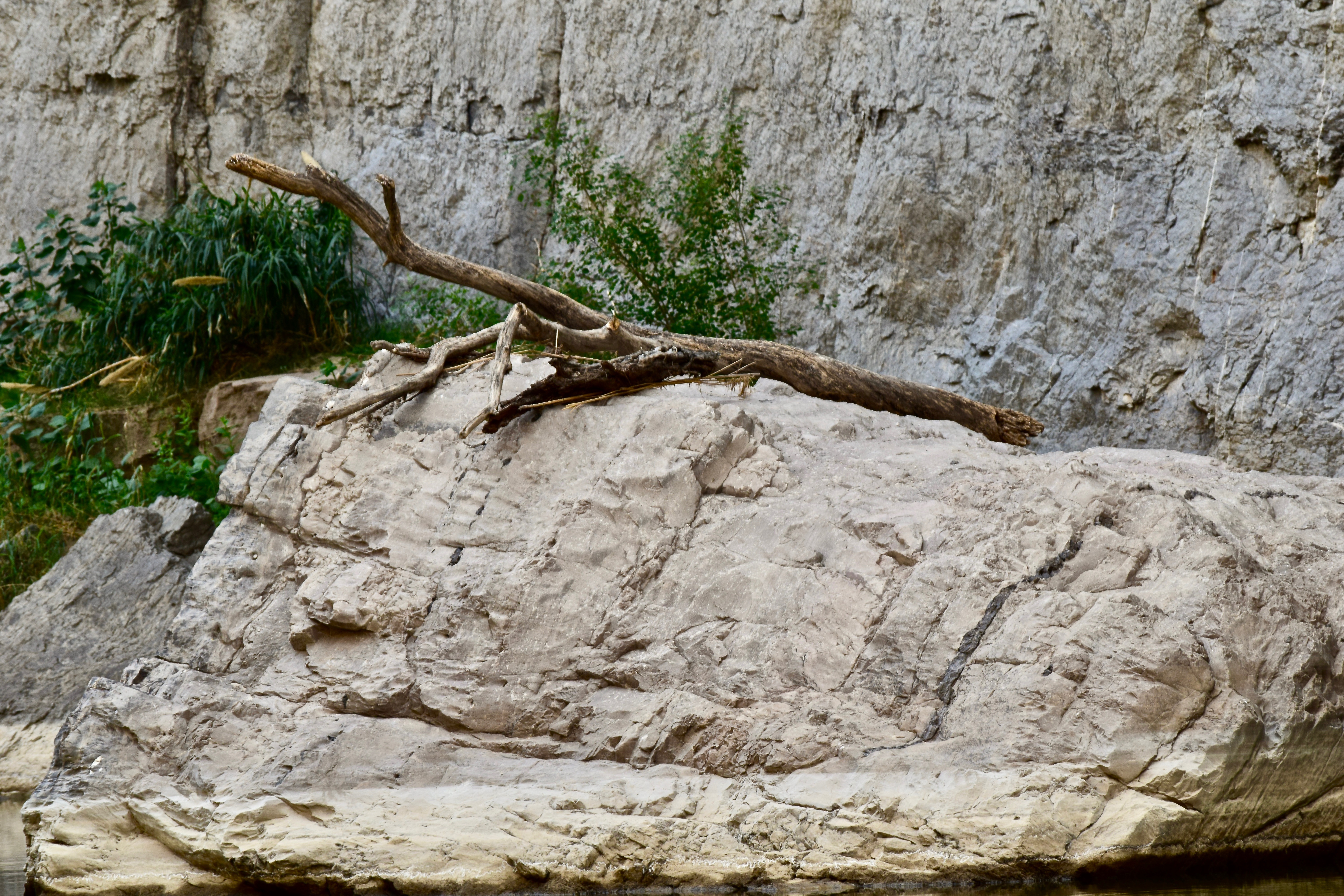
- A stranded log on the banks of the Rio Grande as evidence of periods of higher water.
-

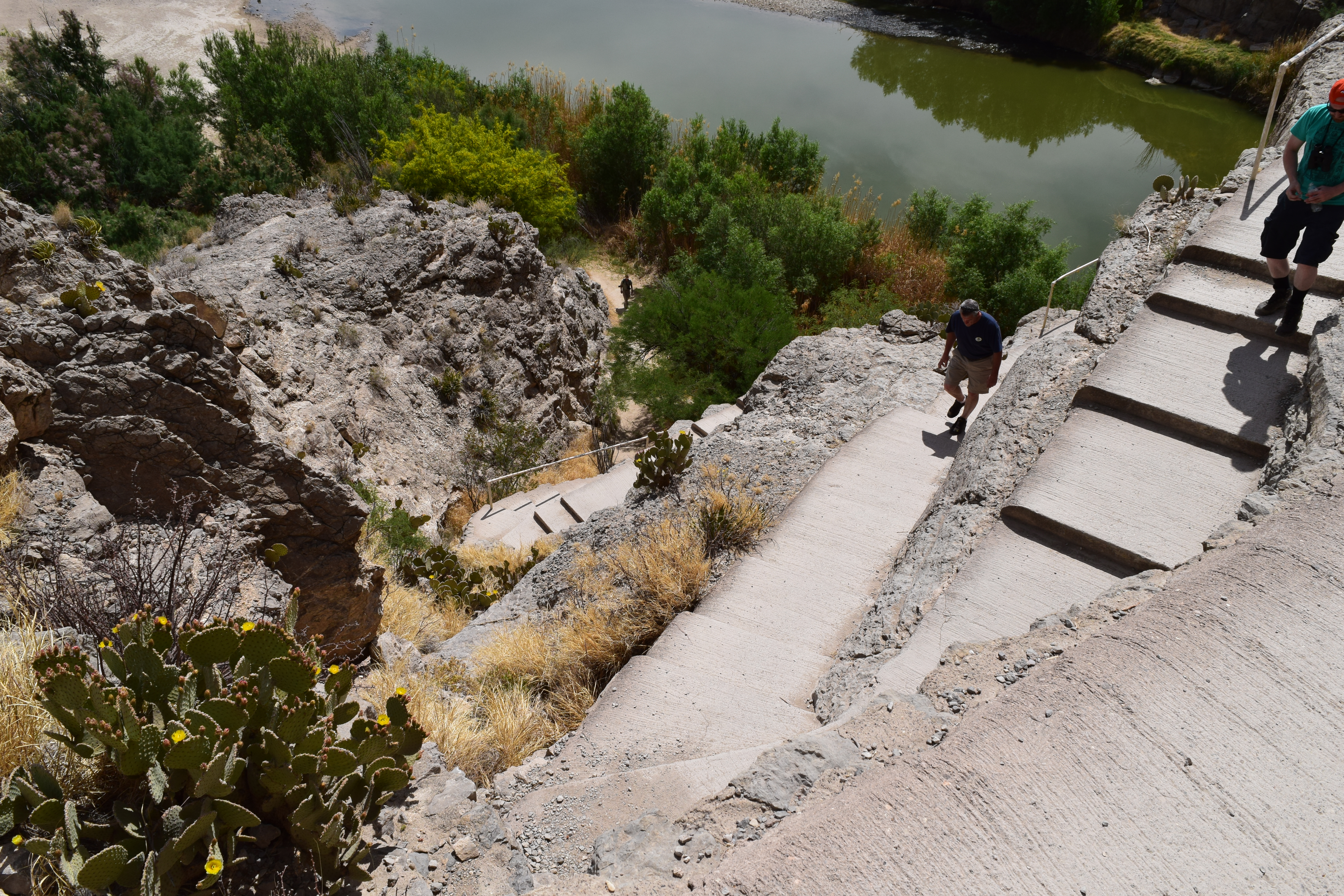
- Hikers entering and exiting the Santa Elena Canyon Trail. Luckily the ascent is at the beginning.
-
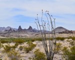
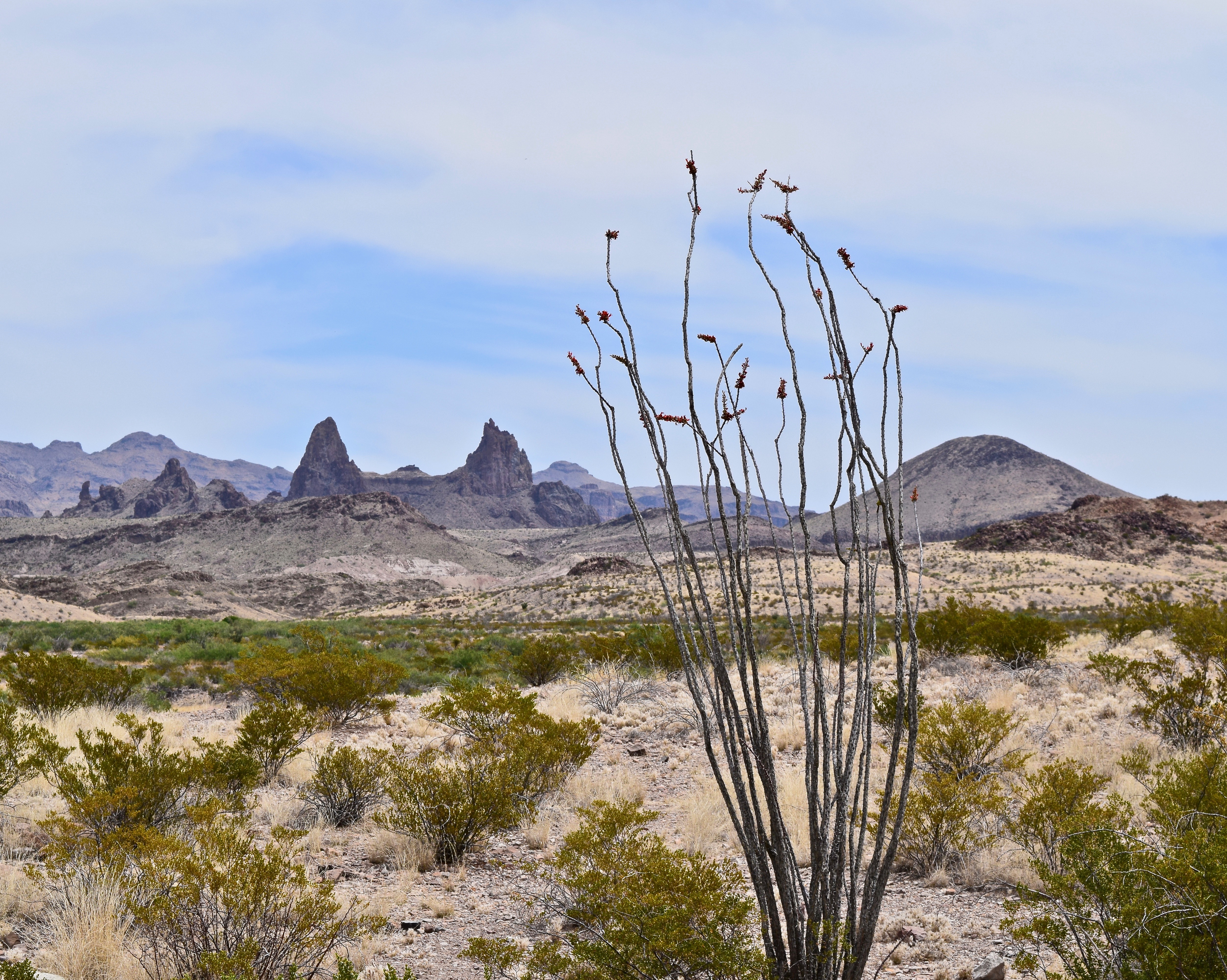
- The Mule Ears formation and the abundant ocotillo plant on the Ross Maxwell Scenic Drive.
-

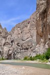
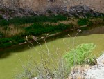
- The Rio Grande beneath the towering vertical walls of the Santa Elena Canyon
-

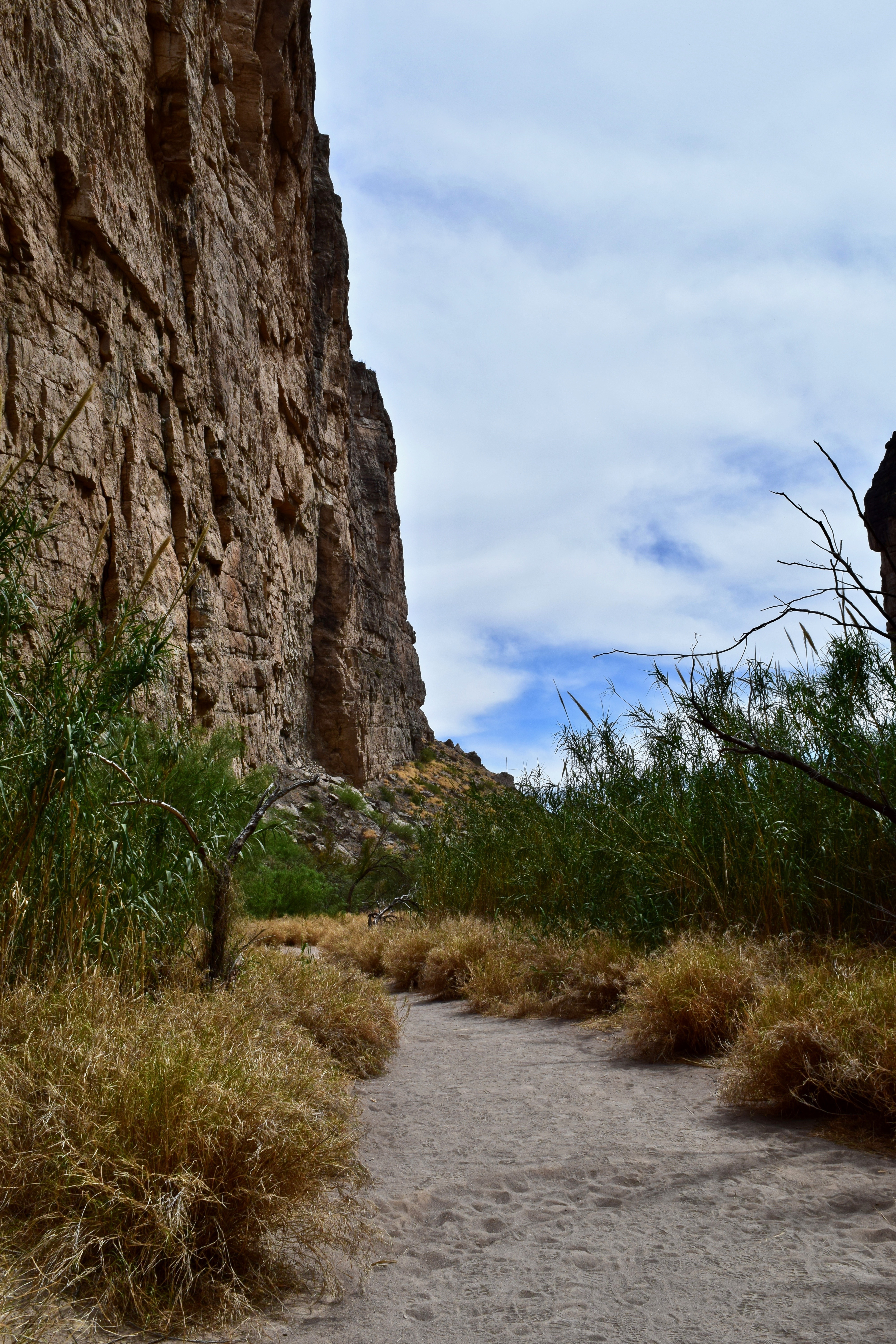
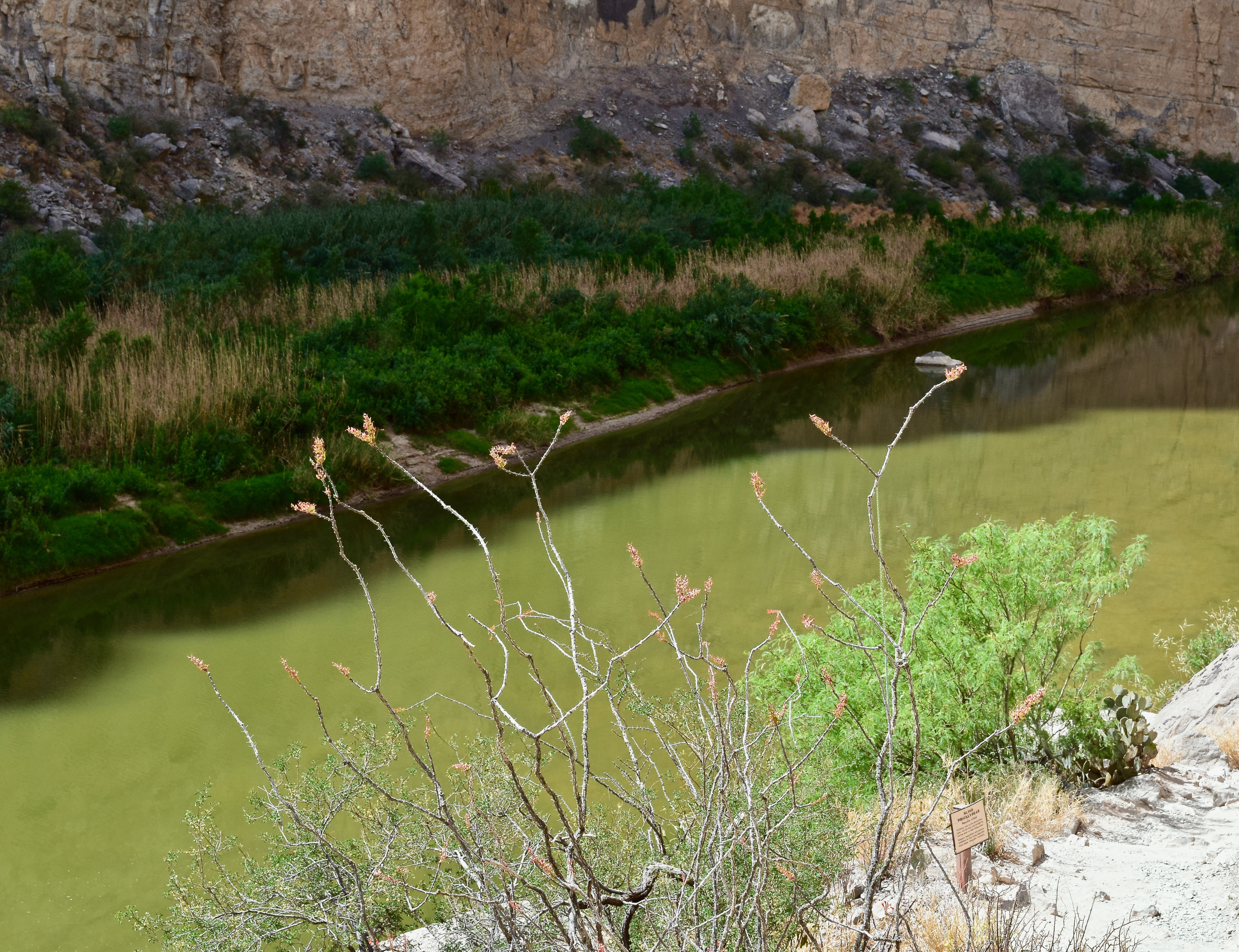
- Hard stalwart canyon walls provide the backdrop for the willowy, flowing reed plants.
-

- Remnants of light volcanic ash and black basalt in the Tuff Canyon area.
-
- The view and some of the many sotol plants at Sotol Vista.
-
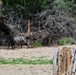
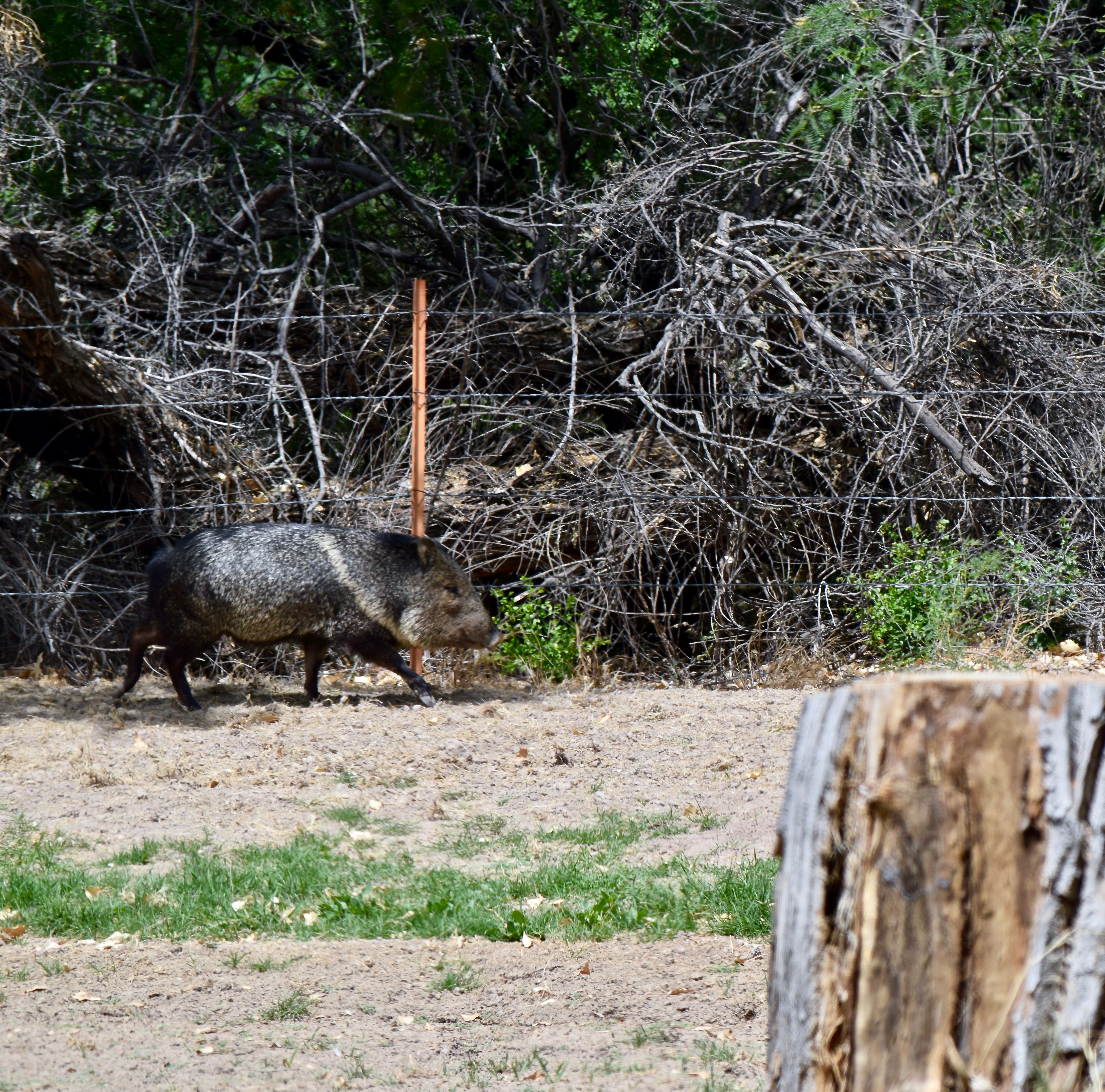
- Not a pig, but a javelina at Cottonwood Campground near Castolon.
-
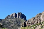
- Casa Grande rises to 7,325 feet with bare rock towering cliffs hovering 2000 feet above the ranger station at Chisos Basin.
-
- Brenda ready to tackle the 1.9 mile Basin Loop. After the fall and knee injury all the other mountain trails are off limits.
-
- Lou Anne on the Chisos Basin Loop Trail with the Window in the background.
-

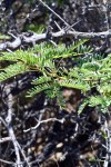
- An Alligator Juniper along the Basin Loop Trail.
-
- The rectangular scaly bark of the Alligator Juniper is a marvel.
-

- The Basin Trail is narrow at times but the Pinon Pine, various oaks, and juniper trees offer a good bit of shade in the upper portion.
-

- Looking south across the basin and the rim toward Emory Peak.
-

- Ran across this fellow, a Southwestern Fence Lizard, I think.
-

- Lou Anne nearing the end of the Loop Trail with a view of The Window.
-
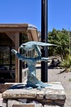
- The Peregrine Falcon statue outside the Chisos Basin Visitor Center. Portions of the trails are closed March through May to protect them during their nesting season.
-
- Dugout Wells is an oasis of green, colorful flowers, and many birds in the midst of the Chihuahuan Desert.
-
- DUGOUT WELLS Desert Nature Trail with Nugent Mountain in the background.
-
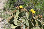
- Imagine what this Blind Prickly Pear will look like when all the blooms are open!
-

- A Strawberry Pitaya bloom.
-

- The Strawberry Pitaya plant in bloom.

-

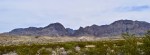
- Sunset on the Sierra del Carmen at Rio Grande Village.
Big Bend Gallery
The gap where the Rio Grande exits the Santa Elena Canyon.
I am finally making public some of my photos from our April 2018 Big Bend Trip. Click on the first photo in each group and you can scroll through the photos in the light box. Unfortunately, I did not upload them all at once, so you will have to view them in groups: BOQUILLAS, THE WINDOW TRAIL, SANTA ELANA CANYON, CASA GRANDE.
I hope there is no wall built along the Rio Grande River. That is not a political statement, but an ecological statement. The land is awesome. The ecosystems both magnificent and fragile. The views are breathtaking. I can not imagine a wall on this sacred land. Take a look and enjoy!!
-
- BOQUILLAS: Boquillas Port of Entry is the only official Rio Grande River crossing along the 118 miles of river border in Big Bend National Park.
-
- Going up the Boquillas Canyon Trail with minimal pain two days after the knee injury.
-
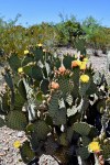
- The Spiny Fruited Prickly Pear cactus along the trail is a reminder to pay attention and stay on the trail.
-
- The Rio Grande winds its way to Boquillas Canyon.
-
- Hickers dwarfed by the massive wall of the Sierra del Carmen on the Texas side of the river.
-
- Boats on the Mexico side of the river. It is reported that at times Mexican musicians use the boats to float up and down the river playing for the hikers. Sometimes they will toss sealed mason jars in the water hoping to retrieve them later filled with money from the hikers.
-
- The limestone and shale canyon wall near the near the entry of Boquillas Canyon–the longest and deepest canyon in Big Bend.
-
- Hiker heading back up the Boquillas Canyon Trail as others start the descent.
-
- THE WINDOW TRAIL: The Window Trail just before it descends again and becomes very rocky.
-
- One of many rest stops on the hike out.
-
- Rock spires along the trail.
-
- A flatter portion of the trail-the Window is the crevice to the right of the peak in the distant center.
-
- Dealing with physical limitations.
-
- Limping up and down the steep rock steps.
-
- Just a small portion of the climb on the return hike.
-
- Hikers enjoying the view and the shade at the Window.
-
- Brenda and Lou Anne with the desert below through the Window.
-
- The lower rocky portion of the Window Trail.
-
- SANTA ELANA CANYON: The Rio Grande making its abrupt turn into the Santa Elena Canyon.
-
- Torrey Yucca with the Chisos in the background.
-
- The lower Santa Elena Canyon Trail plants, mountains, and sky offer an impressive array of colors and textures.
-
- Solititude at the end of the Santa Elena Canyon Trail.
-
- The gap where the Rio Grande exits the Santa Elena Canyon.
-
- A view of the diverse ecology found in Big Bend National Park–the desert, fertile river valley, and mountains.
-
- The Chisos range from Ross Maxwell Scenic Drive.
-
- The Rio Grande from the rocky cliffs of the Texas Mesa del Auguila.
-
- A view of the Mexican Sierra Ponce as the river enters the Santa Elena Canyon.
-
- A stranded log on the banks of the Rio Grande as evidence of periods of higher water.
-
- Hikers entering and exiting the Santa Elena Canyon Trail. Luckily the ascent is at the beginning.
-
- The Mule Ears formation and the abundant ocotillo plant on the Ross Maxwell Scenic Drive.
-
- The Rio Grande beneath the towering vertical walls of the Santa Elena Canyon
-
- Hard stalwart canyon walls provide the backdrop for the willowy, flowing reed plants.
-
- Remnants of light volcanic ash and black basalt in the Tuff Canyon area.
-
- The view and some of the many sotol plants at Sotol Vista.
-
- Not a pig, but a javelina at Cottonwood Campground near Castolon.
-
- Casa Grande rises to 7,325 feet with bare rock towering cliffs hovering 2000 feet above the ranger station at Chisos Basin.
-
- Brenda ready to tackle the 1.9 mile Basin Loop. After the fall and knee injury all the other mountain trails are off limits.
-
- Lou Anne on the Chisos Basin Loop Trail with the Window in the background.
-
- An Alligator Juniper along the Basin Loop Trail.
-
- The rectangular scaly bark of the Alligator Juniper is a marvel.
-
- The Basin Trail is narrow at times but the Pinon Pine, various oaks, and juniper trees offer a good bit of shade in the upper portion.
-
- Looking south across the basin and the rim toward Emory Peak.
-
- Ran across this fellow, a Southwestern Fence Lizard, I think.
-
- Lou Anne nearing the end of the Loop Trail with a view of The Window.
-
- The Peregrine Falcon statue outside the Chisos Basin Visitor Center. Portions of the trails are closed March through May to protect them during their nesting season.
-
- Dugout Wells is an oasis of green, colorful flowers, and many birds in the midst of the Chihuahuan Desert.
-
- DUGOUT WELLS Desert Nature Trail with Nugent Mountain in the background.
-
- Imagine what this Blind Prickly Pear will look like when all the blooms are open!
-
- A Strawberry Pitaya bloom.
-
- The Strawberry Pitaya plant in bloom.
-
- Sunset on the Sierra del Carmen at Rio Grande Village.
In the Moment — September 11, 2015
Jan 9
This gallery contains 10 photos.
Nine—eleven, an infamous anniversary. A day in 2001 when so many lives were lost and so many more were changed never to be the same again. Maybe that is why I have generally been in a “blah” mood today — anniversary feelings of shock, horror, sadness, fear, and so much uncertainty. I am sitting on […]

THE BEACH OUTING! — September 6, 2015
We got up at 7:30 am and were off to MCC Holy Cross of Pensacola by 9:15 am. There was a good crowd at church and I enjoyed the service — praise and worship music was uplifting and the sermon was good. One we all need to hear and heed regarding taking care of our world and the earth because there is no “dealership” where we can go and purchase a replacement.
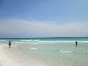 After church we drove to Pensacola Beach on the Gulf Shore National Seashore. The gleaming white sands and crystal clear blue/green water still amazes me. It is so unlike our Texas Gulf – murky, brown, and stinky! We sat our chairs up on the ridge of sand just above the incoming waves and enjoyed our picnic lunch. Of course, we lathered up with sunscreen before eating. The temperature was a both/and. We were both warmed by the sun, and the truth be known it was hot, and cooled by the sea breeze. The seashore is a tease that way! It is hot, but the breeze makes it feel cooler
We went into the water and played for a while letting the waves “wash” us back to shore. I went about 100 yards out, and the water was still only hip to chest deep. In our “washing” we occasionally had to look toward the shore and find our chairs, only to realize that the waves had carried us far down the beach. The “washing” was fun, but walking against the waves to our point of origin proved to be somewhat of a workout for the old legs!
We retired to our chairs and enjoyed the vast view — 180 degrees — horizon to horizon. I listened in darkness to the consistent, rhythmic melody of the soothing rolling surf. I dug my feet into the sand and felt the warmth and cool of the gritty massage. I watched the children playing– on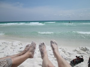 e cute little girl in particular. She looked to be about 18-20 months old and was decked out in a pink and white bathing suit topped with a matching cap. Regardless of coaxing by Mom and older brother and sister, she literally dug her heels in and absolutely refused to go into the water. If the diminishing waves caught her feet, she screamed and ran backwards. She squealed and seemed the most content when grabbing fists full of sand and throwing it in the air. Oh, such simple delights of children!! What a joy!!
As we started back into the water, we noticed an ominous cloud behind us. A front was predicted to come through with a possibility of thunderstorms. With the winds ahead of the front the surf was up moderately and the yellow caution flags were flying. We went back into the water anyway and continued our jumping and “washing” exercise. Of course, occasionally we didn’t jump soon enough or high enough and would get blasted by the wave swell or breaking surf. This brought on episodes of spitting and sputtering and attempts to get the salt water of the mouth and eyes. That usually doesn’t w ork — trying to get salt sea water out of your eyes with hands wet with same is a fruitless effort. Oh, well, just endure the momentary sting and let the natural tears do their thing and all is soon well! The playing continued until we heard the roll of thunder in the distance and saw a flash of lightning.
Out of the water we came, gathered our things, and lugged them back to the car, as did many others. Dripping and gritty we prepared for the drive back to our camper trailer looking forward to a warm shower and dry clothes. Not looking forward so much to the cleanup — sand in the chairs, towels, car, etc. Why is an outing atthe beach so much fun and at the same time takes so much effort? Ah, but that horizon to horizon vista, the rhythmic sound of the rolling surf, the warm, cool sad between your toes, and the squeals of delighted children!! It tickles my soul and makes my spirit soar! No doubt, it is worth the effort!

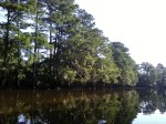
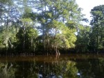
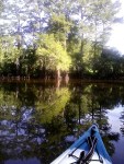
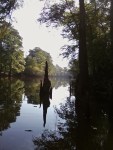
Notes on a Kayak — August 3, 2015
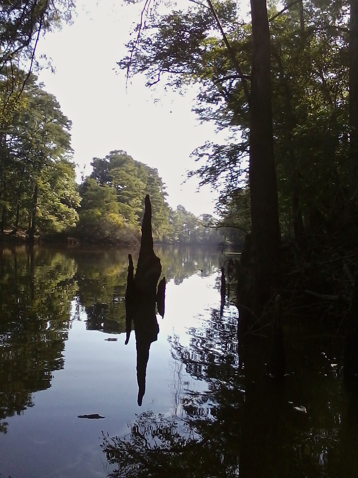
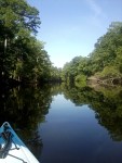
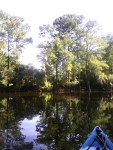
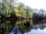
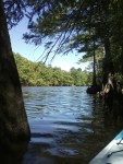
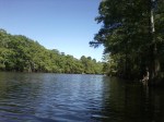
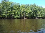
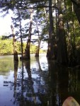
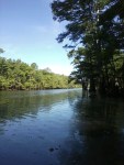
I have moored myself between the cypress knees on the shady east side of Big Cypress Bayou. I am about seven and one-half miles downstream from Jefferson, Texas, and maybe a half-mile from where I entered the bayou at my Dad’s property. Again, “Dad’s property.” He has been deceased almost three years, and I continue to have difficulty saying “my property.”
The dragonflies are buzzing around, hovering inches over the glass surface of the murky, brown water. Brown water that is somewhat out of the ordinary for water that is usually a clearer dark green. I assume that the water has not cleared up after the torrential spring rains and flooding. The water level is continuing to fall – thus, the dirty brown water filled with mud and sil t.
t.
Anyway, back to the dragonflies, which I assume are responsible for the fish jumping just off my bow. I wonder if the fish will actually ever catch the darting dragonflies. Ahh! Could that be why the fisherman’s artificial lure is called a “fly?” Now, that just occurred to me as a new thought; however, as I think about it, I know I have known that or had that thought before. A brain blip, I suppose??
The stillness and the quiet are palpable. The cachophony of sound is delightful. Now is that not a paradoxical observation – or, more accurately, an auditory sensation! In addition to the aforementioned jumping and flopping back into the water and the dragonflies buzzing, I hear the cardinal singing, the woodpecker pecking, the squirrel chattering, a crow cawing, and the cicada’s chorus. Either bank is robed in towering bald cypress and decorated with hundreds of beautiful, yet grotesque looking, cypress knees bent in homage to the life giving trees. Oh, no! Can’t be! Yes, it is—an electric power line is running through the branches of the trees. Oh, well! So much for getting away from civilization.
Scupper plugs! Yes, I did buy and install some scupper plugs, yet I am still sitting in a bit of water. Albeit, not nearly as much as I was before. I’ll still have to work on that I suppose. I also know I have to go. I could stay in this place, in these waters, along these banks for hours on end. I suspect that’s Dad’s place and space still, and forever, in my heart.


THE ROAD LESS TRAVELED. . .
Yesterday, Tuesday 9/16, as we left Abilene State Park and headed north, we literally took the road less traveled. The marvels of the GPS and GoogleMaps are not lost on us as we use both as needed while on the road. We find the GPS helpful in getting from point A to point B. Once in a given area we resort to GoogleMaps, mostly me, as I tend to be the “navigator,” to actually see the map of the area and the street layout. At any rate, with both devices on and laying out a course for the day, they were “at odds.” We opted for the GPS version and headed out on what seemed the most logical and straight line of direction. I realized that the other route, though longer and more circuitous , followed the better main highway. But, the die was cast, and we went via Highways 89 and 126.
As went the road became a bit narrower and, thankfully, still paved and wide enough to accommodate two lanes of traffic with absolutely no shoulder. It would have been a thoroughly modern highway in the 1950’s. At times it felt as if we were riding a bucking bronc. Of course, pulling the travel trailer accentuates the bucking motion! Did I mention the curves? Fairly frequently the road made 90 degree curves — first to the left and then back to the right. Between those we stayed alert to the “S” highway markers. This continued for miles. When not watching the road, I was able to enjoy the country side. Lou Anne was driving. She is a “confident” driver, and I have the utmost of confidence in her driving.
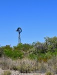
Initially the landscape was washed and gullied and covered with scrub brush and miniature (by East Texas standards), gnarled oak trees. Gradually, the land began to flatten and precise rows of cotton and grains whizzed by us. Then we were into another type of farm — a wind farm. Huge wind turbines dotted the land as far as we could see. The winding road brought us “up close and personal” to the giant windmills of technology. Oh, and beneath the gleaming white of the turning windmills, the green of the cotton fields was broken by the black pumpjacks of the oil wells. rhythmically moving down and up — down to bring the black crude up. All and all, it was a conglomerate of motion — straight line, round and round, and up and down!
As I thought about all that I was seeing, I was struck with just how incredible our earth is! Within this small area the land is providing, at the very least, raw products for food and clothing. The wind is generating power for all sorts of purposes, and oil used in products to numerous to mention is being pumped from beneath the earth’s surface. Incredible indeed! Can we not say that we do live in the Garden! Regardless of one’s beliefs, thoughts, or opinions about the various creation theories — and there happens to be at least ten of them — I, for one, am of the opinion that there was, and IS, an intelligent, creative Higher Power behind it all — be it Big Bang, Creationism, Intelligent Design, etc. Again, JUST MY THOUGHTS! PS
